

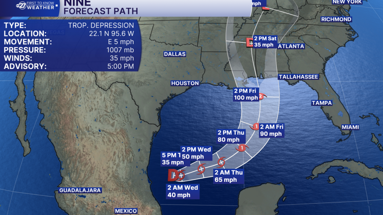


TALLAHASSEE, Fla. (WTXL) — A ragged disturbance in the southwestern Gulf waters, west of the Yucatan Peninsula, has developed into a tropical depression late Tuesday afternoon, with long-range effects projected for the central and eastern Gulf coast later this week.
The tropical depression has peak winds of 35 mph and its movement late Tuesday afternoon was eastward at 5 mph.
The system is over warm ocean waters, and the upper-level winds near it are light. This is a formula that favors some strengthening over the next few days. The intensity forecast from the National Hurricane Center places a category two hurricane near to central Gulf coast Friday.
When it becomes a tropical storm, it will be named Isaias (pronounced "ees-ah-EE-ahs").
The depression is forecast to move east, and then turn to the north by later this week. This projection would keep the core of the system well west of the Florida peninsula, but sections of the Panhandle are within the cone of possible movement of the storm's center.
While specific details have yet to be determined, most indications show the system's center staying west of the Big Bend, so the chance for a local landfall is very low. High pressure is forecast to build to our north and east by the end of this week, which is believed to guide the disturbance generally west of our region.
Nonetheless, this weekend, we will tap into a feed of moisture connected to the system, contributing to higher rain chances and coverage.
We will also monitor closely for chances of local severe weather and adverse effects for coastal and marine areas in terms of rougher surf, rip currents, and higher water levels at high tide.
Want to see more local news? Visit the WTXL ABC 27 Website.
Stay in touch with us anywhere, anytime.
