

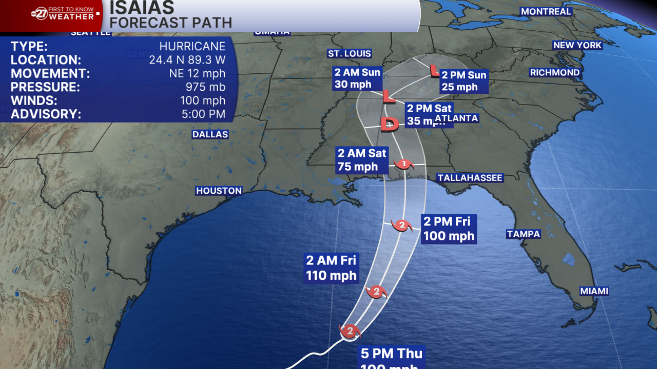


TALLAHASSEE, Fla. (WTXL) — Hurricane Isaias has continued to strengthen and is now a Category 2 hurricane as it moves through the Gulf.
Isaias has peak winds of 100 mph and its movement late Thursday afternoon was northeasterly at 12 mph.
The system continues to move over warm ocean waters, and the upper-level winds near it are light through this evening. This supports gradual strengthening through Friday morning. The intensity forecast from the National Hurricane Center places the core of a category two hurricane near the Florida/Alabama state line late Friday. Some weakening before landfall is anticipated because of the effects of stronger upper-level winds present along the Gulf coast states.
There is no expectation of a landfall happening in the Big Bend area. High pressure is positioned to our north and east, guiding the hurricane to stay west of our region.
Breezes will be felt across the region. The highest chance for tropical storm force gusts exists along the coast and in the Apalachicola River counties, where tropical storm warnings are in effect. Generally lighter breezes will be experienced east in the I-75 corridor. Sustained winds should remain below tropical storm level, with some exceptions at the coast and well offshore.
Tropical moisture connected to the system will contribute to higher rain coverage Friday and portions of early Saturday. Rain totals will be highest in the western side of the Big Bend, topping three to six inches. Lesser amounts are forecast for the Suwannee River and I-75 southern Georgia sections, generally up to three inches there.
Coastal water levels will increase a few feet thanks to the onshore wind flow. Storm surge warnings are in effect for the whole stretch of coastline. Water levels over usually dry ground will increase one to three feet in the eastern Big Bend coastline, with increases of two to five feet in coastal Wakulla and Franklin counties through Saturday.
We will also monitor closely for chances of local severe weather Friday night and Saturday from bands of squally rain and storms, which can produce quick-developing but brief spin-up tornadoes for the Big Bend area.
Want to see more local news? Visit the WTXL ABC 27 Website.
Stay in touch with us anywhere, anytime.
