


NORTHWEST TALLAHASSEE, FL — The National Hurricane Center is rolling out updates to the forecast cone for the 2026 hurricane season, expanding watches and warnings to include both coastal and inland counties.
WATCH FULL REPORT BELOW:
During the 2024 and 2025 seasons, the National Hurricane Center released experimental cones alongside the usual operational cone updates to test their effectiveness. After obtaining successful results, officials decided to officially incorporate the changes into the 2026 hurricane season.
Any tropical storm and hurricane watches and warnings will now include both coastal and inland counties.
"It's going to be better to help us communicate and explain to folks where those impacts are going to be felt, where folks are under threat from tropical storm conditions, hurricane conditions, and explain how those impacts will be," Senior Service Hydrologist at the National Weather Service-Tallahassee, Kelly Godsey, said.
Prior to 2026, watches and warnings were displayed with a colored line along the coast indicating where the watch or warning was. That became confusing, as it was unclear how far inland the watch or warning extended.
Under the new format, the color coordinating to a watch or warning will be extended inland, allowing everyone to know exactly what criteria they are in.
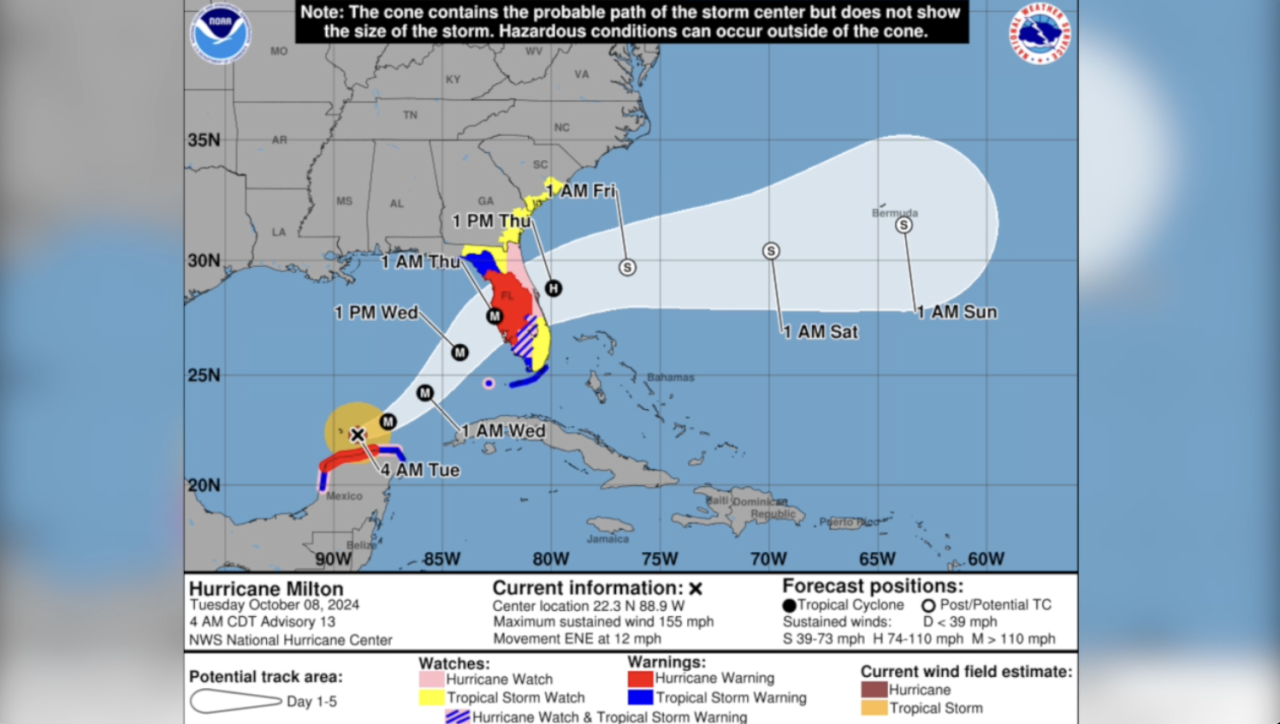
"Overlaying watches and warnings on the map, we're actually showing folks that those impacts extend far outside the cone," Godsey said. "So if you're in an area that's shaded, whether that's a tropical storm warning, hurricane warning, you need to be prepared for those impacts in your community, even though you're outside the cone because it's not an impact cone. It's a track cone. It's where the center of the storm could be, and we know with all tropical systems that impacts extend far away from the center of the storm."
Another change: if a particular area is in both a hurricane watch and a tropical storm warning, it will be displayed with pink and blue hatching.
The next step is making the cone itself more understandable and accurate. The National Hurricane Center will include another experimental cone as a test alongside the operational cone with each advisory throughout the season on their website.
Want to see more local news? Visit the WTXL ABC 27 Website.
Stay in touch with us anywhere, anytime
Like us on Facebook
Follow us on Instagram and X.
