


UPDATE
Feb. 21; 4:30 p.m.:
The Marginal area remains the same for possible severe weather overnight. The main threat continues to be gusty winds (40 - 60 mph), but there is now a slight chance for hail within the isolated storms. A brief tornado is also possible, but this threat remains very low.
Storms could arrive as early as 11 p.m. with the bulk of the activity moving through between 12 a.m. and 5 a.m. Sunday morning.

Rainfall totals remain on the lower side (0.25" - 0.5") with isolated neighborhoods reaching 0.5" - 0.75".
Original
Feb. 20:
We are in a Marginal Risk (Level 1 out of 5) for severe weather. This means one or two isolated severe storms are possible through this event. Strong storms can start as early as 12 AM., but the severe threat has a better chance from around 1:00 A.M. to around 5:00 a.m. with scattered showers lingering into Sunday morning. The sun will come out by the afternoon.
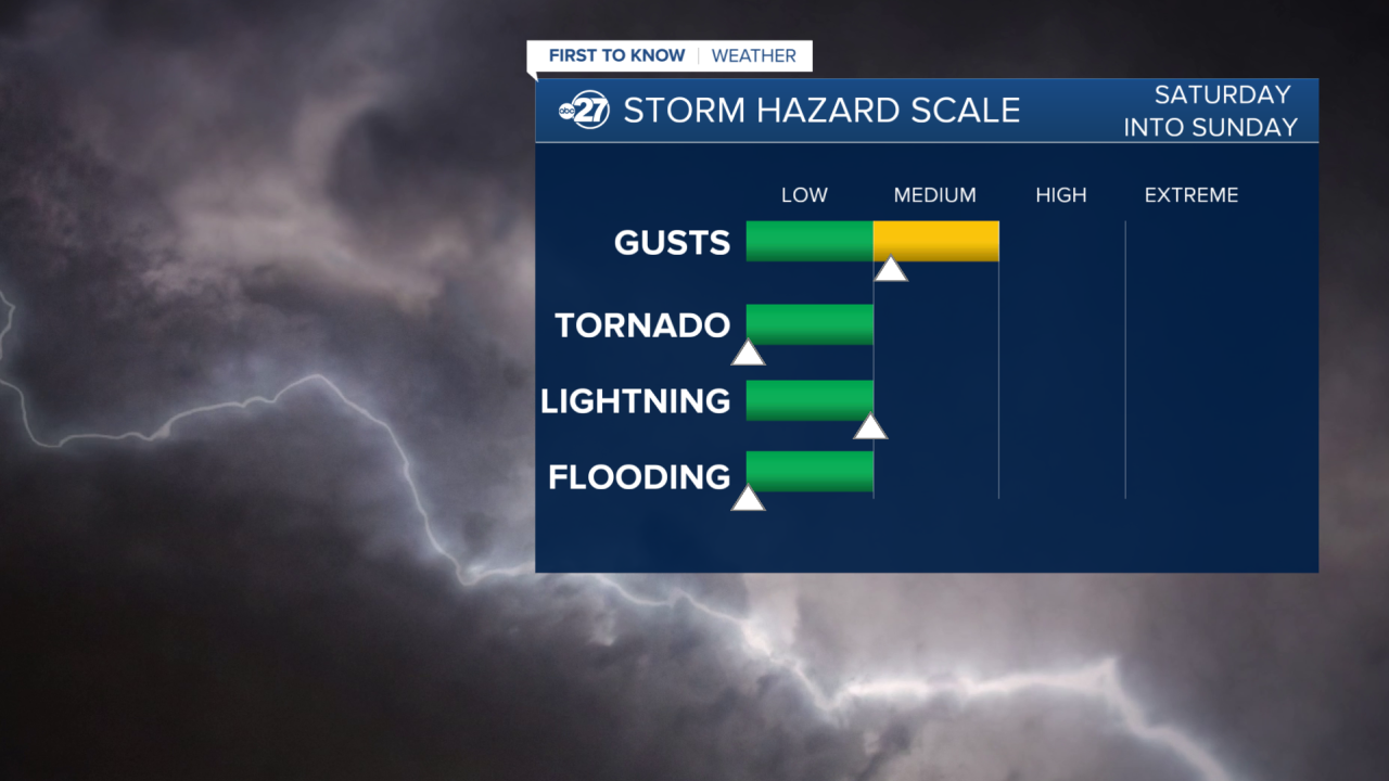
The Main Threat with this system will be Strong Gusts around 40-60 mph. The only other major threat would be Frequent Lightning, but the threat is low. Tornadoes, hail, and flooding are not expected with this event. Rainfall totals are likely to be around 0.25" on average.
This is still a changing forecast so stick with us for updates!
Want to see more local news? Visit the WTXL ABC 27 Website.
Stay in touch with us anywhere, anytime.
