


TALLAHASSEE, Fla. (WTXL) — Hurricane Erin will move north, a little more than 100 miles off the coastline of North Carolina Wednesday. It will pose no threat to our local area.
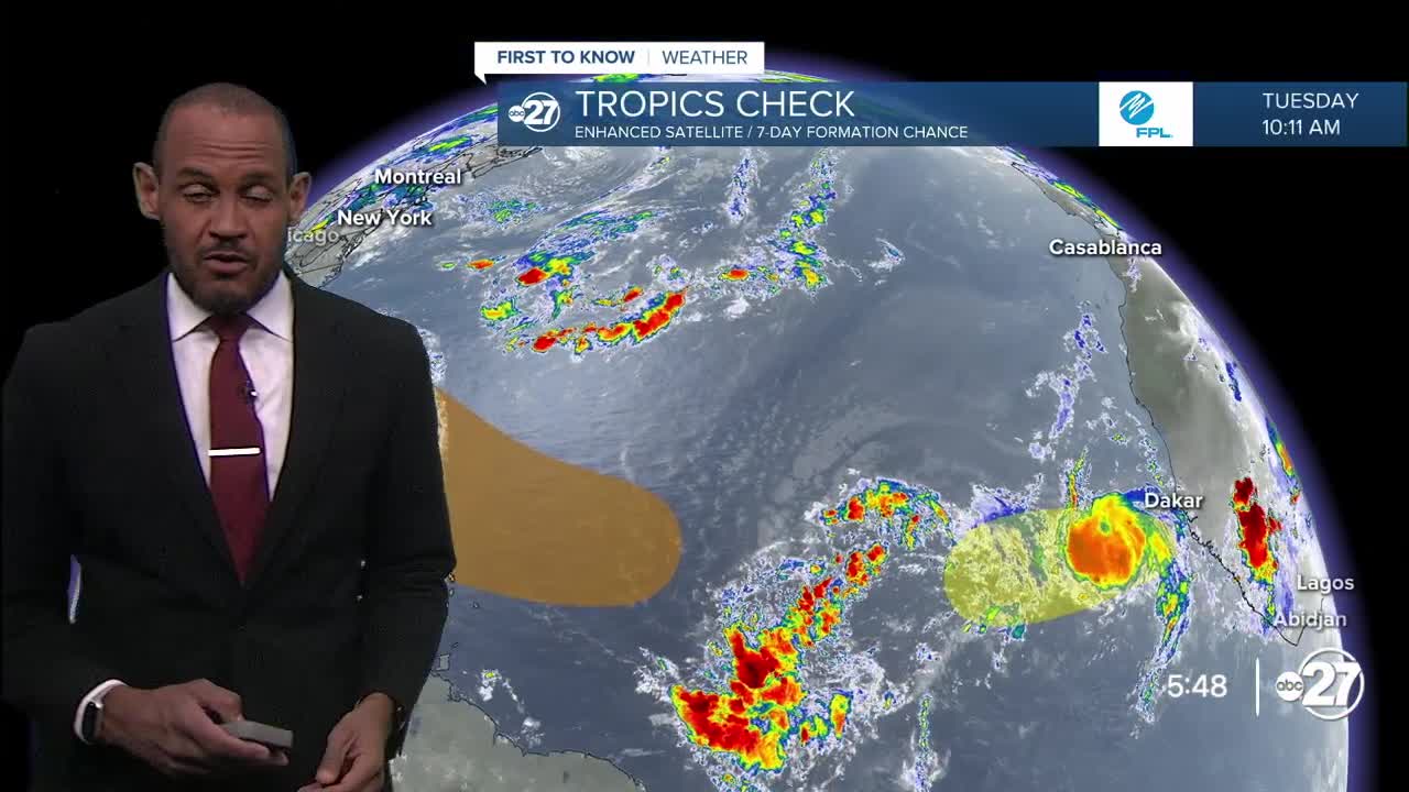
One system that is still disorganized and far from any land is shown to have modest chance to form into a tropical depression later this week. As it moves west-northwest, it will encounter a zone of drier air, likely hindering its development efforts as it generally travels toward the islands of the Lesser Antilles.
A second wave of activity is east of the first one, closer to the Cape Verde Islands. It may also run into areas of limited moisture and slow development efforts if that were to come to pass over the next 10 days.
There are no dangers to the Big Bend expected within the next week.
Want to see more local news? Visit the WTXL ABC 27 Website.
Stay in touch with us anywhere, anytime.
