



TALLAHASSEE, Fla. (WTXL) — Update
July 19; 9 a.m.
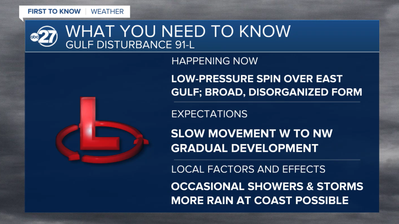
The sloppy, broad disturbance in the eastern Gulf continues to have some higher development chances over the warm waters of the eastern Gulf early this week.
Rain and thunderstorm action has increased within the disturbance, situated south of the Big Bend and west of the Florida Suncoast (west coast). Forecast indicators show the chance for the disorganized spin to continue on a slow movement to the west to northwest today and tomorrow.
The National Hurricane Center pegs its development chances at high-end 80%. This means further formation into a tropical low is likely. When it is deemed to create a chance for tropical storm conditions along part of the Gulf coast, the system can undergo an upgrade to a "Potential Tropical Cyclone" prior to actually becoming a tropical depression, at which time advisories would be issued.
The main implication this would have for the Florida/Georgia line region early this week is an increase in local rain production. Times of sunshine will still occur, but we'll monitor for the chance of passing bands of rain and thunder affecting coastal areas. Winds would not be particularly gusty outside of individual thunderstorms and offshore waters.
We will continue to monitor and analyze the latest forecast information and further refine our outlook on this system as time progresses.
Update
July 18; 8 p.m.
As of the 8 p.m. update from the National Hurricane Center, chances of formation continue to slowly rise.
Next 48 hours: 40% chance of development
Next 7 days: 50% chance of development
Slow development of the system is possible as it makes a slow trek towards the west/northwest. The strength and track is still no where near exact as there is lots of time. Local impacts remain the same: increase rain coverage through the rest of the weekend and early parts of the week. No major impacts are expected at this time.
July 18; 2 p.m.
A very broad surface low has began to form Saturday morning causing the National Hurricane Center to tag the disturbance as Invest 91L. Development chances have now entered the 'medium' category over the next 7 days.
Next 48 hours: 30% chance of development
Next 7 days: 40% chance of development
As thunderstorms associated with the disturbance remain disorganized, slow development is possible as it slowly drifts towards the west/northwest over open waters. Rapid development is not expected with this system.
Locally, impacts have not changed. Expect an increase in shower activity through Saturday afternoon and evening, Sunday, and to start the work week.
Long range models continue to be inconsistent with development, but do have the slow drift towards the west/northwest occurring over the next few days.
Original
July 17
A relatively weak disturbance in the eastern Gulf this upcoming weekend is being monitored by First to Know Weather and the National Hurricane Center.
There are no clear signals recently among forecast data for anything significant or strong to develop from this zone of moisture. But, with broad low pressure present near the Florida west coast Friday afternoon and a flare-up of rain and thunderstorms, forecast indicators show the chance for the disorganized spin to drift over the northeastern or eastern Gulf through the weekend.
The main implication this would have for the Florida/Georgia line region this weekend is a possible enhancement in local rain production, particularly in the Suwannee River region and coastal sections. Times of sunshine are still anticipated, especially the farther inland one goes.
The forecast trends have been inconsistent and are generally imprecise. Most show the disturbance moving slowly to the west or northwest. Upper-level winds aren't particularly suitable for robust development of the disturbance, but the circulation will be placed over the warmer waters of the northeastern Gulf over the next couple of days.
Expectations for anything significant to develop from this disturbance are quite low at this point. It's not impossible for the system to gain some gradual organization into early next week. Conditions will be checked for any chances of it being considered a "potential tropical cyclone" by the National Hurricane Center, at which time an official forecast track and related advisories would be issued.
We will continue to monitor and analyze the latest forecast information and further refine our outlook on this system as time progresses.
Want to see more local news? Visit the WTXL ABC 27 Website.
Stay in touch with us anywhere, anytime.
