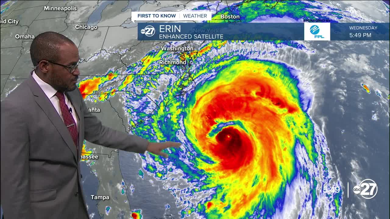


TALLAHASSEE, Fla. (WTXL) — Hurricane Erin will move north to northeast Thursday and beyond, paralleling the U.S. east coast before zipping into the open North Atlantic waters. It will pose no threat to our local area.
One system is a few hundred miles from the Leeward Islands and still has a modest chance to form into a tropical depression later this week. As it moves northwest, it will run into an area of drier air, slowing strengthening efforts.
A second wave of activity is east of the first one, west of the Cape Verde Islands. It may also run into areas of limited moisture and slow development efforts in the short term, but can overcome those obstacles over the weekend or early next week.
No tropical hazards are foreseen for the Big Bend region within the next week.
Want to see more local news? Visit the WTXL ABC 27 Website.
Stay in touch with us anywhere, anytime.
