


TALLAHASSEE, Fla. (WTXL) — As we move throughout the early evening, temperatures will stay on the warmer side with showers approaching, but change is on the way!
Overnight, temperatures will drop slightly as the cold front pushes through with lows in the mid to upper 50s. Showers associated with the cold front will begin to move through as early a 8-9 p.m.. This showers will mainly remain calm, but a few isolated stronger storms are possible in northwestern neighborhoods. As they move eastward, however, they are expected to weaken. They will move out of our area by 3-4 a.m..
An interesting weather pattern will then be in place. As the sun rises Sunday morning, temperatures will actually be dropping as we enter the backside of the cold front. Highs will stay in the upper 50s to low 60s for southeastern neighborhoods. However, winds will be sustained at 10-15 mph with wind gusts as high as 20-25 mph.
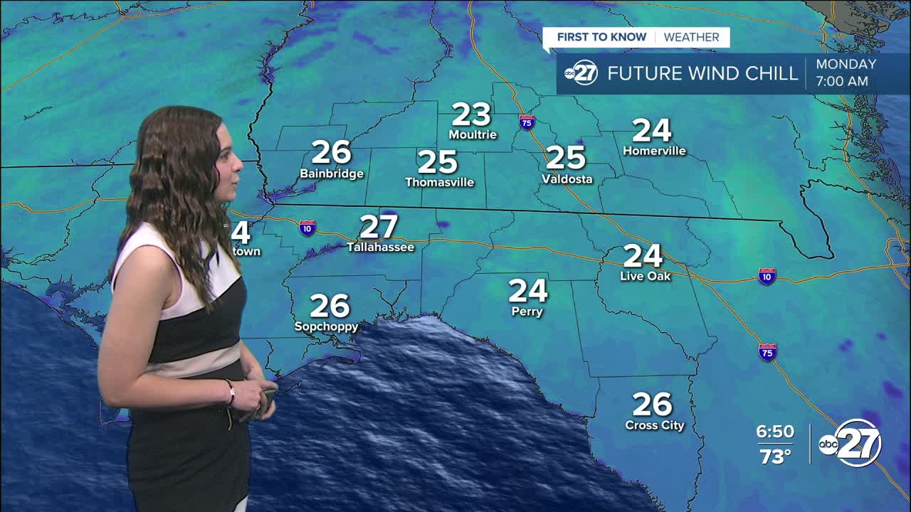
These winds will stick around for Sunday night where temperatures are expected to drop to the 30s but feel like the 20s when the wind is factored in. Cold weather shelters will be open Sunday night. You can find a full list of shelters here. Clinch county is already in a Freeze Watch for overnight Sunday as temperatures are expected to get as low as 28° with wind chills as low as 25°.
The rest of the week remains on the cooler side. Temperatures will begin to rebound back to the 60s Tuesday into Wednesday, but a secondary cold front will bring them back down with highs in the 40s Thursday.
Stay warm!
Want to see more local news? Visit the WTXL ABC 27 Website.
Stay in touch with us anywhere, anytime.
