


TALLAHASSEE, Fla. (WTXL) — The cold air has arrived and we have dropped about 20 degrees so far, but the biggest drop will be felt Sunday night and Monday morning.
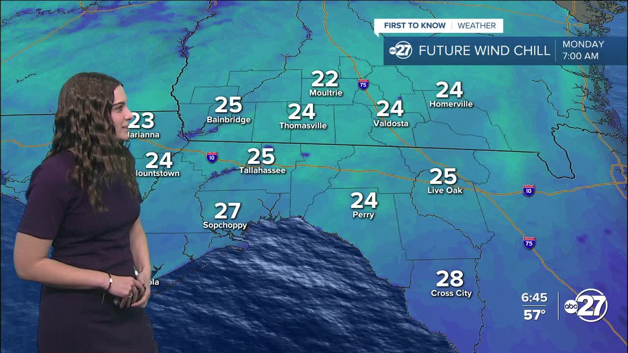
Now that we are behind the cold front, temperatures are dropping and winds are picking up leaving us with wind chills in the 50s for the rest of the day and 20s overnight.
We will stick with the partly cloudy skies throughout the night.
Temperatures will quickly drop with the sunset, getting into the 40s by 8 p.m.. Overnight, everyone will get down into the 30s with feels-like temperatures well into the 20s. This has prompted a Freeze Watch for Echols county that expires 8 a.m. Tuesday and a Freeze Warning for Clinch county that expires 9 a.m. Monday. We will keep en eye out for an expansion of these advisories westward and will update this article if anymore are issued.
Cold weather shelters are opening Sunday night and a full list of shelters can be found here.
Highs Monday will remain in the 50s.
As for the rest of the week, two more cold fronts are set to move through. The first one Wednesday, and the second one Saturday. Temperatures will try to rebound back up, but the cold fronts will reinforce the cooler temperatures. Showers are expected with the Wednesday front, but the Saturday one seems to be on the drier side.
Stay warm!
Want to see more local news? Visit the WTXL ABC 27 Website.
Stay in touch with us anywhere, anytime.
