


TALLAHASSEE, Fla. (WTXL) — As cold front slide north of our area, and the vast tropical moisture is contained south of us in the Florida peninsula, we around the state line region continue to exist in a zone of generally settled, low-stress, seasonably warm conditions, with a void of significant rain or thunderstorm risk.
This evening will transition to a mainly clear sky after sunset with a light northeast to east wind flow. Temperatures will fall through the 80s and enter the 70s before midnight.
There's a little more moisture in the air, so morning lows will be closer to the 70° with upper 60s in inland areas by the time the sun rises.
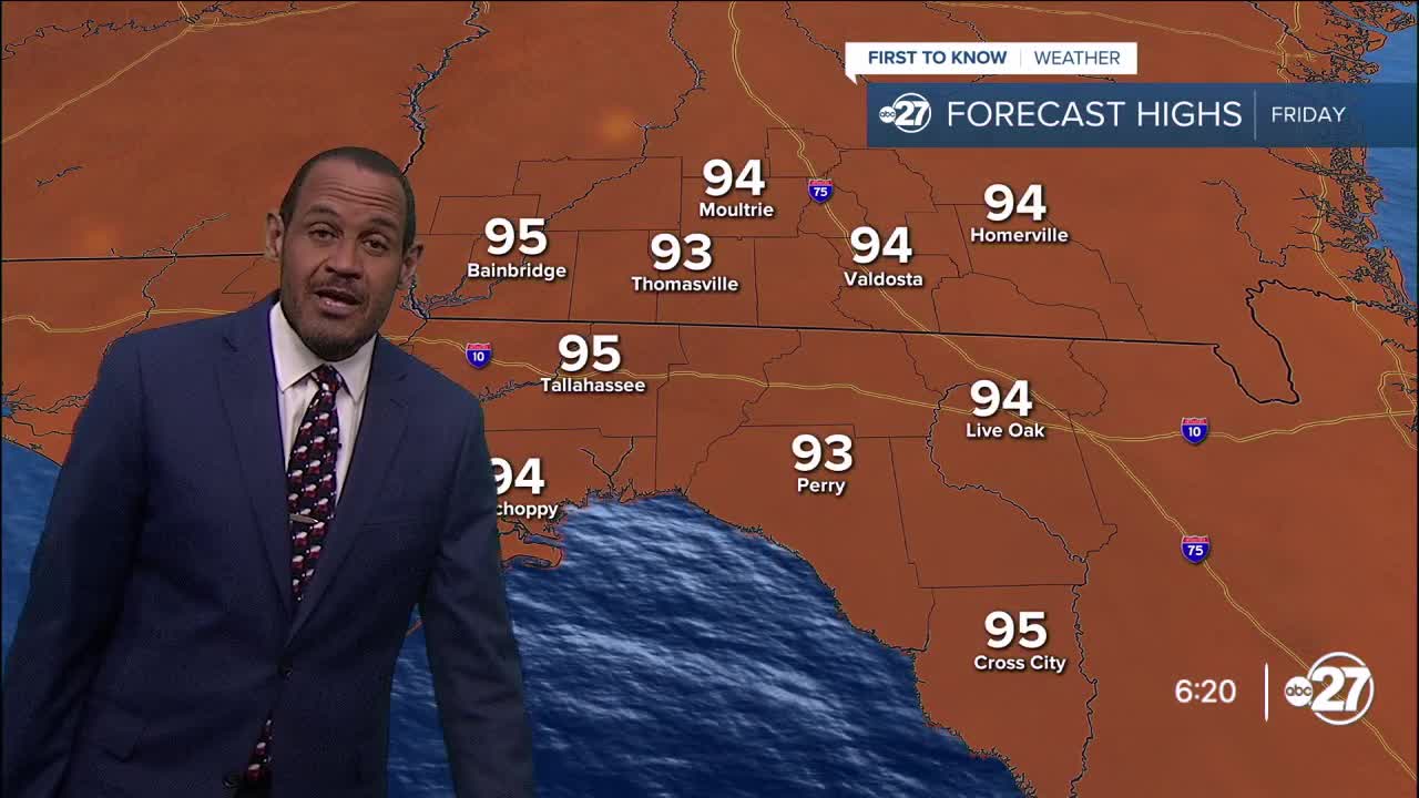
Friday looks similar to previous days this week, as clouds and sun with mix together in the afternoon. We'll avoid excessive cloud cover, and any showers will be isolated and mainly brief.
High temperatures are projected to be in the low to mid 90s.
Over the weekend, Saturday will be the driest of the two days, and likely the hottest. It will be partly cloudy with an isolated shower and storm chance with highs in the mid 90s. Sunday will have a slightly better opportunity for showers and storms as a cold front approaches. That front will bring about better chances for rain action in the next work week while bumping down daily high temps to the upper 80s.
--Casanova Nurse, Chief Meteorologist
Want to see more local news? Visit the WTXL ABC 27 Website.
Stay in touch with us anywhere, anytime.
