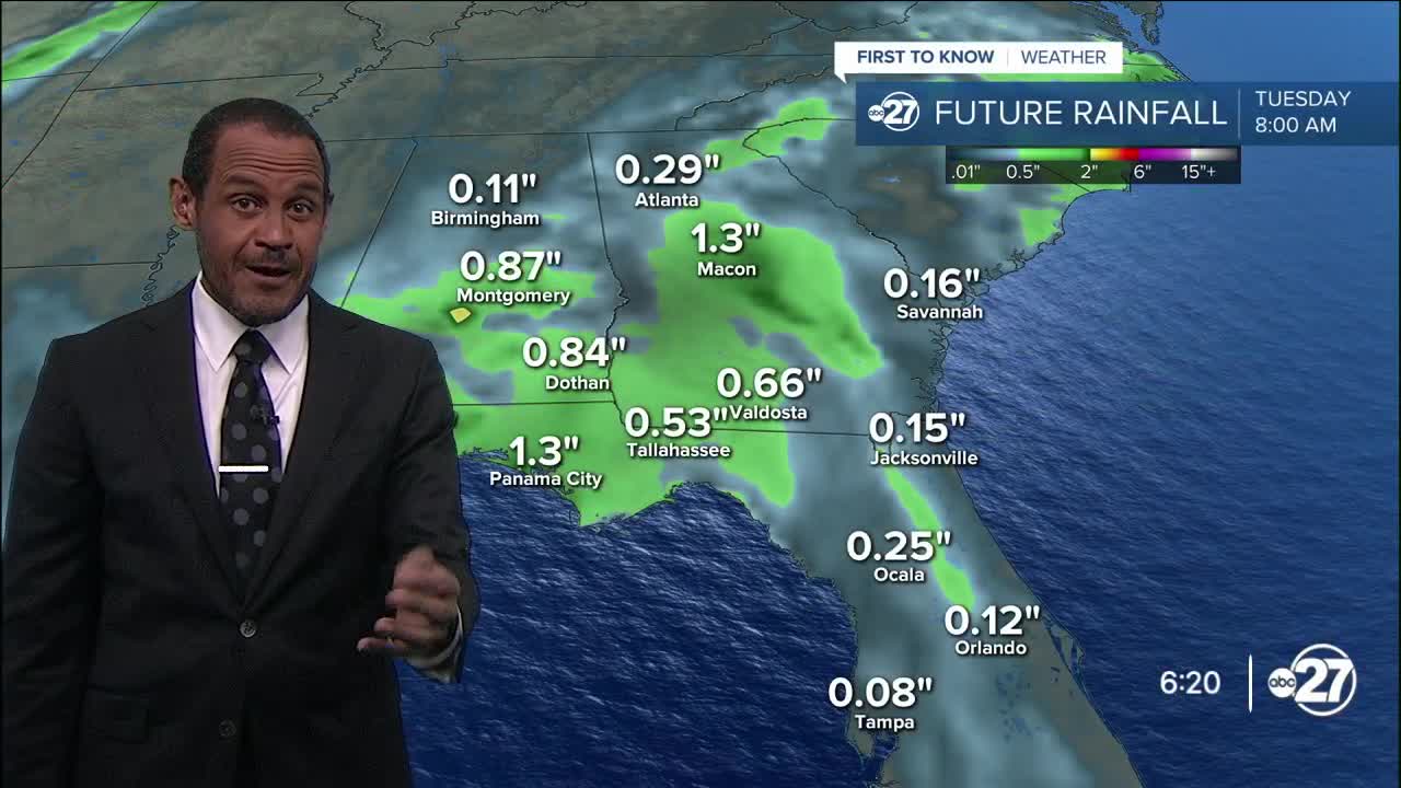


TALLAHASSEE, Fla. (WTXL) — We are still socked under a deeply moistened atmosphere — typical of August — and layers of clouds prompted by a stretch of low pressure and a weak disturbance off the Florida Panhandle. Southeast and south winds are the result locally, with patchy showers present along that flow.
Partial clearing is possible later tonight, with areas of broken cloud cover and isolated showers overnight, particularly along the coast.
Temperatures will go from the 80s this evening to the 70s later with lows in the mid 70s by sunup Tuesday.
The nearby disturbance will keep moving west-northwest, but a steady south flow will maintain humid conditions area-wide and help promote scattered showers and some thunderstorms in the daytime hours. What does form will tend to move north. Breaks of sun will shine in between, getting highs closer to 90° in the afternoon.
Through the week, a zone of high pressure will scoot in from the east. This won't eliminate daily rain chances, but the system will reduce the broad nature of the cloud cover recently and will bump up high temperatures closer to the middle 90s. The coverage of spotty to scattered showers and storms will be more focused on the afternoon and evening hours and more reliant on sea breeze boundaries to get the rain cycle started.
—Casanova Nurse, Chief Meteorologist
Want to see more local news? Visit the WTXL ABC 27 Website.
Stay in touch with us anywhere, anytime.
