


TALLAHASSEE, Fla. (WTXL) — It's been remarkably cool over the last few mornings, with massively dry air and a clear sky the main elements triggering the cool-down. The afternoons have remained hotter and will still be that way for the next several days. The continue north to northeast wind influence will keep moisture somewhat limited tonight and Tuesday, leading to clouds dissipating after sunset and areas of clear sky widespread for the late-night and morning hours.
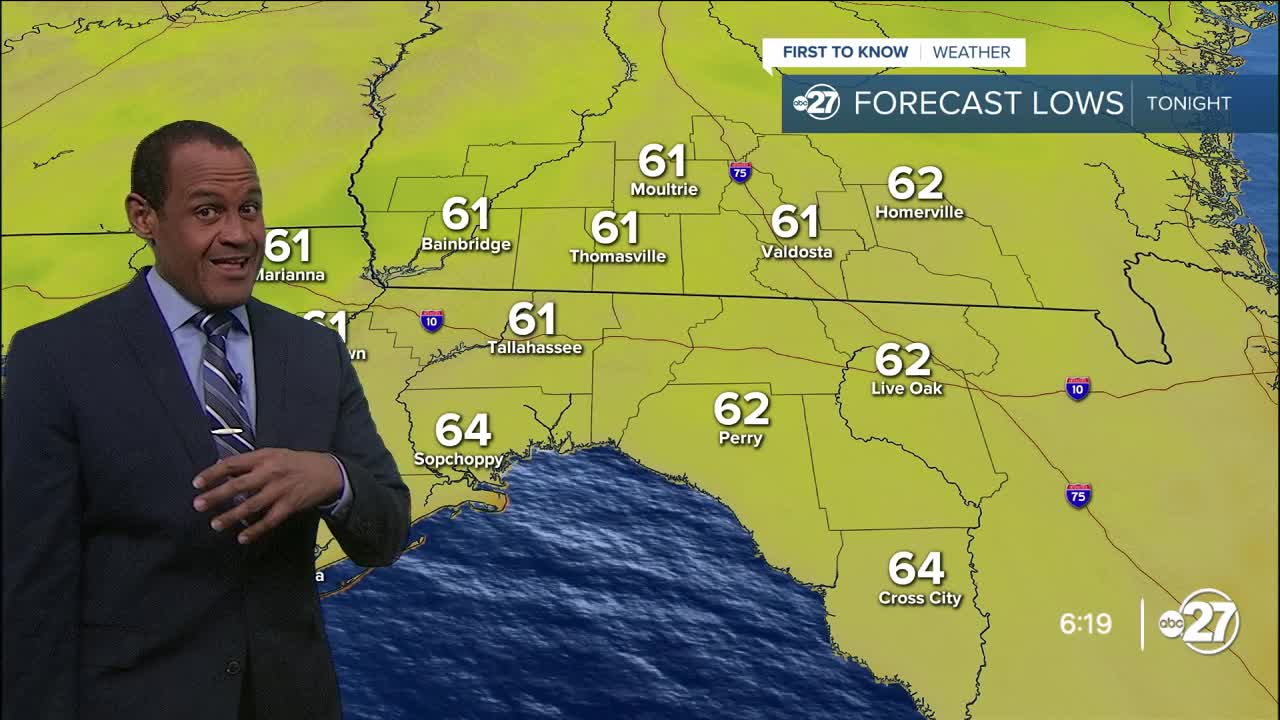
Forecast temperatures will go from near 90° early this evening to the 70s before midnight. Morning lows will fall into the lower 60s again around the state line, with some 50s in southern Georgia, and low to mid 60s near the coast and the southeast Big Bend.
Ample sunshine will resume in the morning and stretch into the afternoon with another round of fair-weather puffy clouds in the afternoon. Rain is not anticipated with highs in the upper 80s and lower 90s with ongoing lower humidity.
Only subtle weather changes are foreseen through midweek. Some sources of moisture nearby will creep in on east winds later this week, which will support more of a partly cloudy sky for the afternoons and help in forming a couple of isolated showers by the week's end. While rain chances are particularly healthy and widespread, a few more will be scattered around this weekend amid times of sunshine and clouds, and it will feel more humid during the afternoon with highs between 90° and 94° between Thursday and Sunday.
—Casanova Nurse, Chief Meteorologist
Want to see more local news? Visit the WTXL ABC 27 Website.
Stay in touch with us anywhere, anytime.
