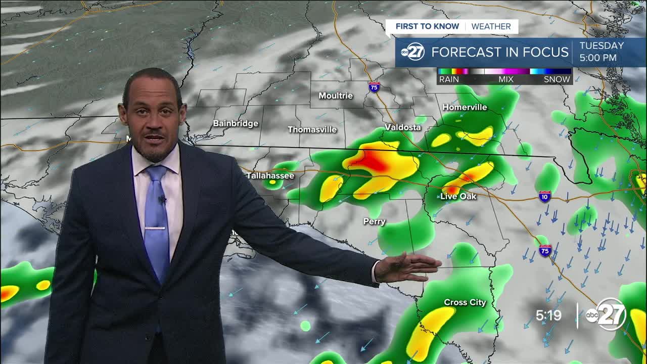


TALLAHASSEE, Fla. (WTXL) — The cold front from Sunday is slowing down over the lower Suwannee River region late today, and that is where most of the daytime showers and storms are present. A few passing showers and thunderstorms are possible through the late-night hours for coastal counties along the Big Bend, and isolated showers north to the I-10 counties. The air is progressively drier in southern Georgia, where rain is not expected to happen.
Evening readings will be mainly in the 80s, falling into the 70s before midnight. Inland areas (southern Georgia) will see temperatures reach the mid and upper 60s for morning lows Tuesday, with lower 70s for most of the northern Florida counties.
The front is set to meander across the northern Florida peninsula Tuesday. That's where most of the scattered shower development will be focused. Some areas of rain and showers will develop or creep into the Suwannee River counties, with associated cloud cover masking the sunshine in nearby neighborhoods throughout Tuesday. A clearer and less humid trend is foreseen in southwestern Georgia.
High temps Tuesday will be in the mid to upper 80s. It'll still feel slightly humid, especially in areas more prone to rain.
The midweek time frame keeps a slight decrease in overall cloudiness in the picture, and a further reduction in showers and storms for the southeast Big Bend. A steady northeast wind flow this week will tap into much drier air to the north of us and eventually displace the muggy feel with lower-moisture air that will cause morning lows to fall back into the 60s for several mornings. Rain chances for the last half of the week will be near or at zero.
—Casanova Nurse, Chief Meteorologist
Want to see more local news? Visit the WTXL ABC 27 Website.
Stay in touch with us anywhere, anytime.
