


TALLAHASSEE, Fla. (WTXL) — Showers and storms will eventually come to an end Sunday evening with the driest and coldest air of the season behind them.
Temperatures Sunday night will drop to the upper 30s to low 40s, with daytime highs Monday not leaving the 50s. Winds will be coming out of the northwest at around 10-15 mph, so it will be feeling more like the 40s.
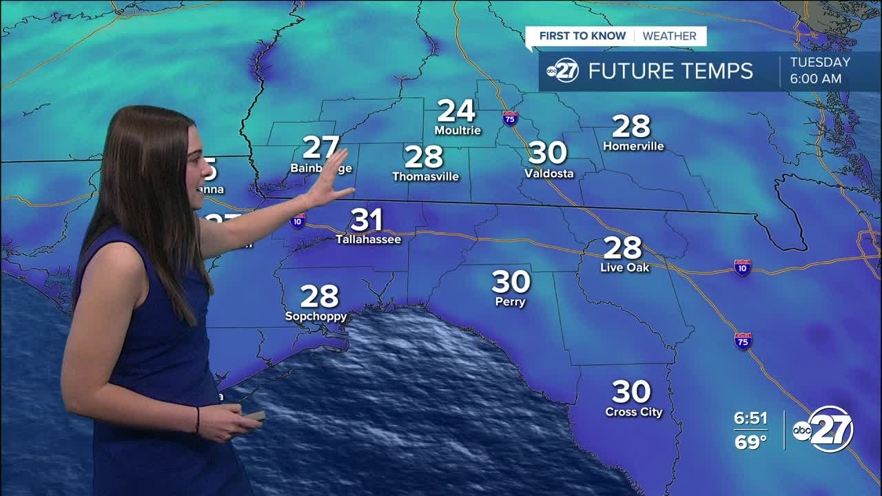
It gets colder Monday night! Overnight lows will plummet to the 20s and 30s across the area with wind chills in the teens and low 20s.
There will be nothing but sunshine during the day, but it won't be feeling warm as daytime highs will stick in the 50s both Monday and Tuesday.
A Freeze Watch is in effect for everyone across south Georgia and the Big Bend from Monday night to Tuesday morning due to sub-freezing temperatures. A Hard Freeze Watch is in effect for Jackson, Seminole, Decatur, Miller, Baker, and Mitchell counties Monday night through Tuesday morning as temperatures will be the coldest in these areas.
The cold temperatures and potential for frost can kill crops and damage vegetation, so please make sure you are taking the necessary precautions including bringing potted plants indoors or covering them in fabric.
Emergency shelters will be opening to ensure everyone stays safe and warm. Click here to see a list of shelters.
Stay warm!
Want to see more local news? Visit the WTXL ABC 27 Website.
Stay in touch with us anywhere, anytime.
