


TALLAHASSEE, Fla. (WTXL) — Clouds are rolling in and showers are popping up as moisture continues to be pushed in from the Gulf and a front slowly approaches.
Lows Friday night will slowly drop to the lower 50s, but it is going to be a muggy one as dew point temperatures are also in the 50s. This could allow patches of fog to pop up Saturday morning.
Saturday will be filled with cloud cover and a few spotty showers mainly towards the late afternoon and evening hours. Highs will be similar to Friday, sitting in the upper 60s to low 70s.
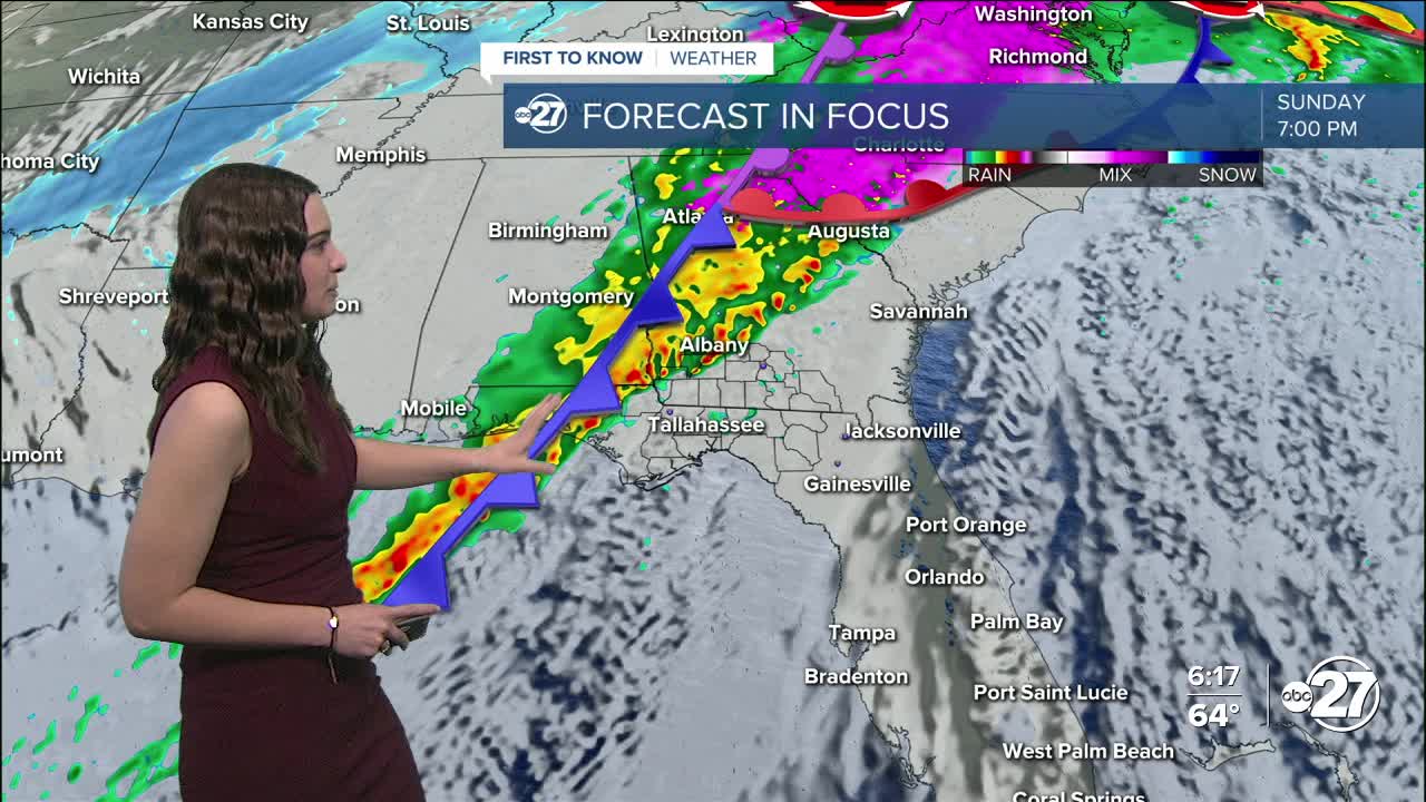
Sunday is when the cold front approaches the area and dumps a good amount of rainfall. Thunderstorms, some on the stronger side, will be mixed in as well. The timing for this line of storms is between 7 p.m. Sunday - 2 a.m. Monday.
A majority of our viewing area, excluding portions of Suwannee, Lafayette, and Taylor counties, are in a level 1 out of 5 (Marginal) risk for seeing isolated severe storms. The main threats are strong winds (gusts of 40 mph) and a brief tornado is possible.
However, once we get behind the storms, another threat arrives: cold temperatures.
Temperatures will not take long to drop with highs Monday only reaching the upper 40s and lows dropping back down to sub-freezing. Winds behind the front are also expected to be on the stronger side, so wind chills will be in the teens overnight.
Cold weather shelters will be open starting Sunday night. You can find a full list of shelters here.
Make sure to stay safe and stay warm!
Want to see more local news? Visit the WTXL ABC 27 Website.
Stay in touch with us anywhere, anytime.
