


TALLAHASSEE, Fla. (WTXL) — The sunshine is back, but so is the cold air!
The cold front that passed through overnight was a strong one and we are feeling the effects of it today and will feel even more overnight tonight and Monday.
Lows tonight will drop to the upper 20s to low 30s, but when you factor in the 10-15 mph winds, wind chills will be in the teens and low 20s.
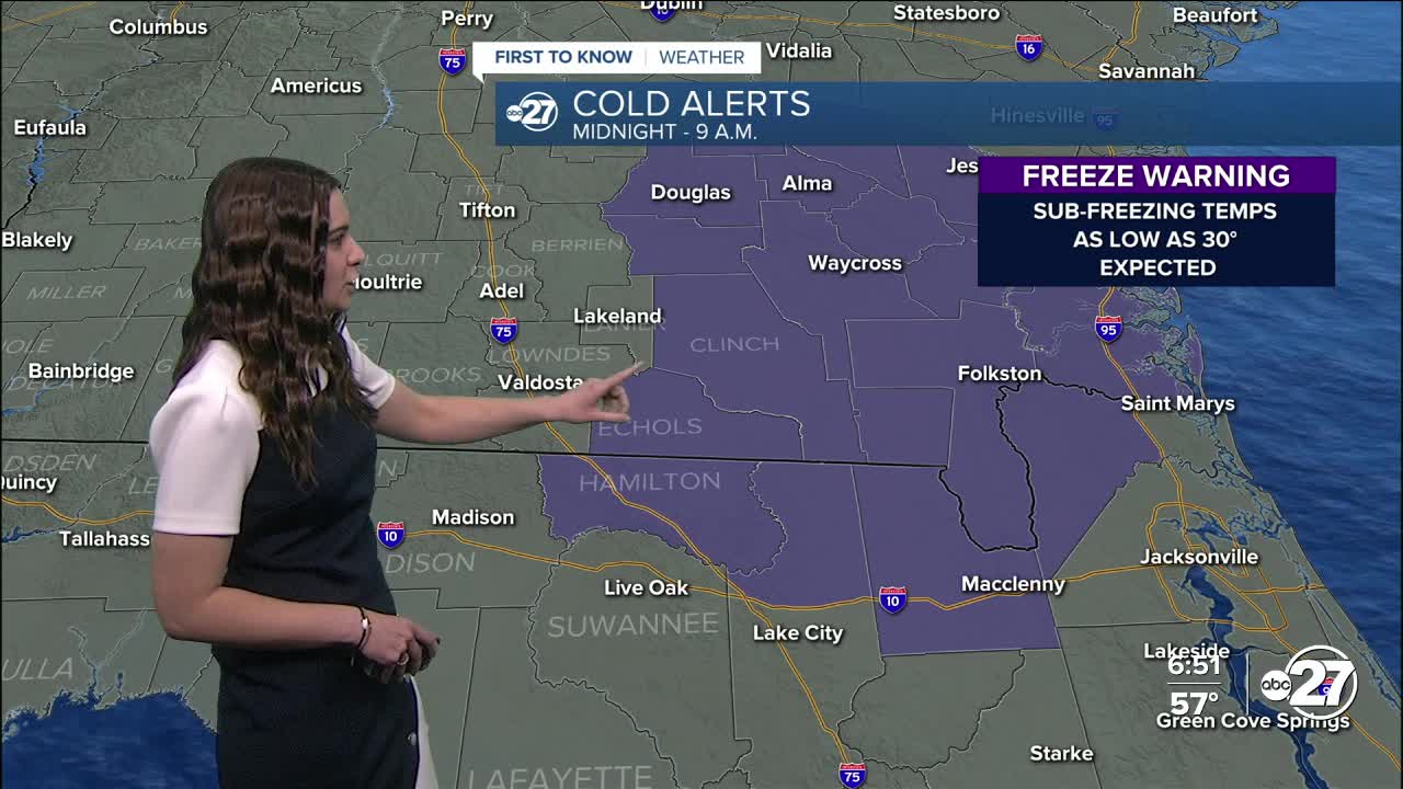
A Cold Weather Advisory is in effect for all counties from 5 a.m. to 9 a.m. Monday morning as wind chills are expected to drop as low as 17°. Additionally, a Freeze Warning is in effect for Clinch, Echols, and Hamilton county from midnight tonight to 9 a.m. Monday morning as temperatures as low as 30° are expected.
Highs Monday will stay in the upper 40s to low 50s but feel much cooler as the wind is expected to stick around. Monday night is set to be the coldest of the week with temperatures dropping to the 20s for a majority of the area.
A Freeze Watch is in effect for Clinch, Echols, Hamilton, and Suwannee county Monday night through Tuesday morning as temperatures as low as 25° are possible. This is expected to be bumped up to a warning during the day Monday.
Cold weather shelters have opened. You can find a full list of shelters here.
However, the cold won't be here for long as temperatures will warm up throughout the week, eventually getting back to the 70s come Thursday. Rain is also expected to return towards the end of the week.
Stay warm!
Want to see more local news? Visit the WTXL ABC 27 Website.
Stay in touch with us anywhere, anytime.
