


TALLAHASSEE, Fla. (WTXL) — The cold front has fully moved out and temperatures have taken a 20° drop.
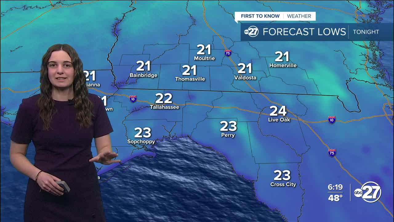
Skies will remain clear overnight, but temperatures will drop even further, eventually reaching the low 20s. Additionally, the winds are expected to stay on the stronger side at 10-15 mph gusting to 20 mph at times. This will cause feels-like temperatures to be in the teens for most with the possibility of single digits.
A Freeze Warning and Extreme Cold Warning are in effect starting at 9 p.m. tonight. The Freeze Warning is for every county, and the Extreme Cold Warning is for every county except Echols, Hamilton, and Suwannee.
For the Freeze Warning, temperatures as low as 18° are expected and for the Extreme Cold Warning, wind chill values as low as 8° are expected.
Both advisories expire at 11 a.m. Tuesday.
Temperatures Tuesday will again struggle to reach the 50s. This will be the trend for the week: overnight lows in the 20s and highs in the upper 40s to low 50s.
Please remember the four P's: People, Pets, Pipes, and Plants as these cold temperatures will reach dangerous levels. If you need a warm place to stay, cold weather shelters are open. You can find a full list of shelters here.
Stay warm!
Want to see more local news? Visit the WTXL ABC 27 Website.
Stay in touch with us anywhere, anytime.
