


TALLAHASSEE, Fla. (WTXL) — Highs Friday will climb into the mid to upper 80s with plenty of sunshine!
We had rain to start the week, but we won't have anymore beneficial totals in the near future as a high pressure is stationed to our north, keeping us dry.
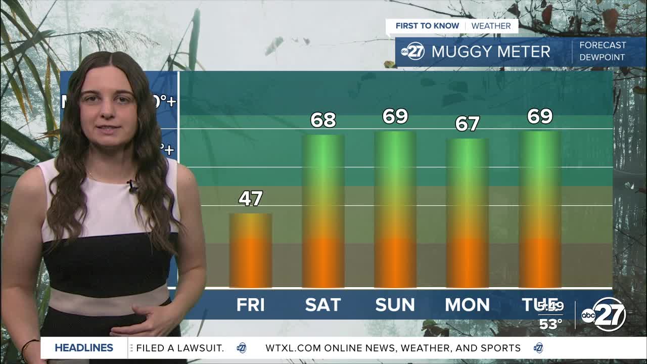
Once that high shifts to the east over the weekend, it will cause our winds to become southeasterly, pushing in moisture from the Atlantic. Humidity levels will climb as a result, leaving us with hot and humid conditions starting Saturday.

Temperatures will also climb into the low 90s for daytime highs, but once we factor in the humidity, feels like temperatures will easily be in the mid to upper 90s.
Another result from the southeasterly wind flow is light shower activity. Mixing the winds with the sea breeze and daytime heating can easily pop up a few showers along the I-75 corridor starting as early as Saturday afternoon and continue throughout the days afterwards.
Want to see more local news? Visit the WTXL ABC 27 Website.
Stay in touch with us anywhere, anytime.
