


TALLAHASSEE, Fla. (WTXL) — While our 2025 tropical storm season has been relatively tame in comparison to previous years, we are just nearing the typical height of development frequency in the Atlantic waters.
Since 1944, the highest amount of tropical storm and hurricane development in the Atlantic basin (which includes the Caribbean Sea and the Gulf of America/Gulf of Mexico) has occurred in the first two weeks of September. While many factors are involved in where tropical cyclones form, the most ideal setup of warm ocean waters, limited upper-level wind shear, repetitive moisture-laden disturbances from western Africa, and reduced dryness from the Saharan Air Layer create a zone of development from the Cape Verde Islands to the Caribbean and southwestern Atlantic where systems have the opportunity to grow into stronger storms and hurricanes as they travel west.
Depending on steering features, like the strength and stretch of a high-pressure zone over the Atlantic, these westward-moving storms can continue on a trek deeper into the Caribbean and the Gulf, or take an early northwest to north turn over the western Atlantic waters.
The nearby waters of the Gulf and Caribbean are also prone to tropical development. Sometimes more favorable in late September, areas of lingering moisture near or over these waters can work with atmospheric patterns to spark a low-pressure system to form that can strengthen from the rich warm waters usually in place in the western Caribbean and the southern Gulf.
A weekly product called the Global Tropical Hazards Outlook is updated by NOAA's Climate Prediction Center. It projects — based on broad mid-range forecast data, general weather patterns worldwide, and historical information — where in the Atlantic basin tropical depressions are possible or more likely to form.
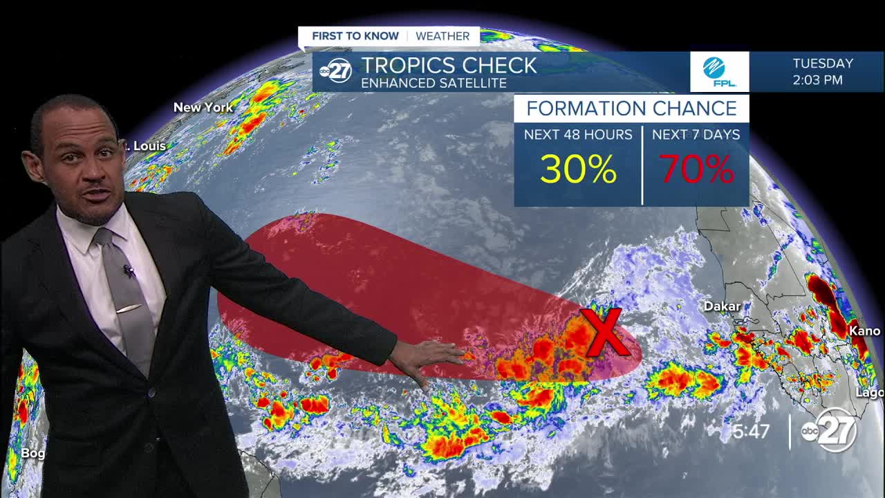
The update from Sept. 2, 2025, highlights zones where September systems are already most likely to form — the "Main Development Region" east of the island chain of the Lesser Antilles, and a zone of low-end development potential straddling the southern Gulf and northwestern Caribbean.
The outlook does not specify what will form, and what strength is expected, as pinpointing precise systems two and three weeks away is next to impossible. But signals and patterns can suggest where hotbeds of storms sprouting up can be focused. It also doesn't suggest how many disturbances can become depressions or more.
It's a fine reminder that a quiet season up to this point does not guarantee a quiet rest of the season ahead, even though we are already past the halfway point of the 2025 hurricane season. Some of the region's most memorable storms, including Michael, Helene, and Milton, came in late September and later.
First to Know Weather will keep you in the know about legitimate tropical threats to the Big Bend and surrounding areas with enough advance notice so you can be ready for any action the rest of the season may have to offer.
Want to see more local news? Visit the WTXL ABC 27 Website.
Stay in touch with us anywhere, anytime.
