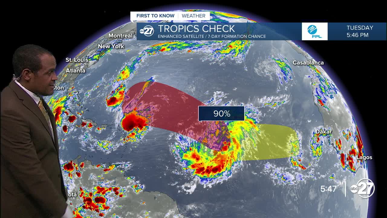


TALLAHASSEE, Fla. (WTXL) — The "Intertropical Convergence Zone" in the lower North Atlantic where mid-season tropical systems tend to form is presenting two disturbances that have various levels of development potential Tuesday evening.
The persistent disturbance called 92L is forecast to move west, then west-northwest, through the end of this week. It will encounter some slots of drier air which may slow down development efforts, but most reliable forecast data suggest the system will gain enough organization and strength to become a depression by the weekend.
The same data also signals the system staying over the Atlantic Ocean waters, with a long-range turn to the north indicated, keeping it away from the Gulf and the US east coast, if this trend verifies.
A second source of moisture is entering the far eastern waters of the tropical North Atlantic, set to pass near the Cape Verde Islands as these types of system commonly do. It's projected to move west and run into a broader dry-air source. Short-term development will be limited.
Gabrielle is the next name to be used, followed by Humberto.
In the near-term, there are no tropical threats foreseen for the Caribbean or the Gulf regions this week.
Want to see more local news? Visit the WTXL ABC 27 Website.
Stay in touch with us anywhere, anytime.
