


TALLAHASSEE, Fla. (WTXL) — Hurricane Erin will move farther away from the U.S. east coast Friday, eventually zipping into the open North Atlantic waters. It will pose no threat to our local area.
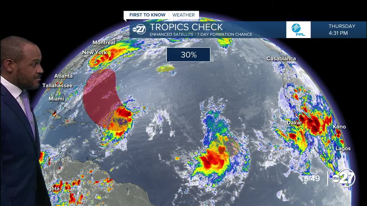
The ragged tropical disturbance a few hundred miles from the Leeward Islands will go west-northwest, then northwest, over the weekend as it overcomes dry air to gain some organization. All reliable indicators point to the system remaining over the waters of the Atlantic this weekend and next week.
A second wave of activity is east of the first one, west of the Cape Verde Islands. It may also run into areas of limited moisture and slow development efforts in the short term, but the circulation may hold together and continue to be tracked into next week.
A minor swirl well west of the Azores is pegged with a low-end chance for further development. It doesn't create a concern for tropical effects for the U.S.
No tropical hazards are foreseen for the Big Bend region within the next week.
Want to see more local news? Visit the WTXL ABC 27 Website.
Stay in touch with us anywhere, anytime.
