


TALLAHASSEE, Fla. (WTXL) — October and November represent the final two months of the Atlantic hurricane season, and the opportunity for late-season systems to form closer to the waters of the Gulf and the Caribbean.
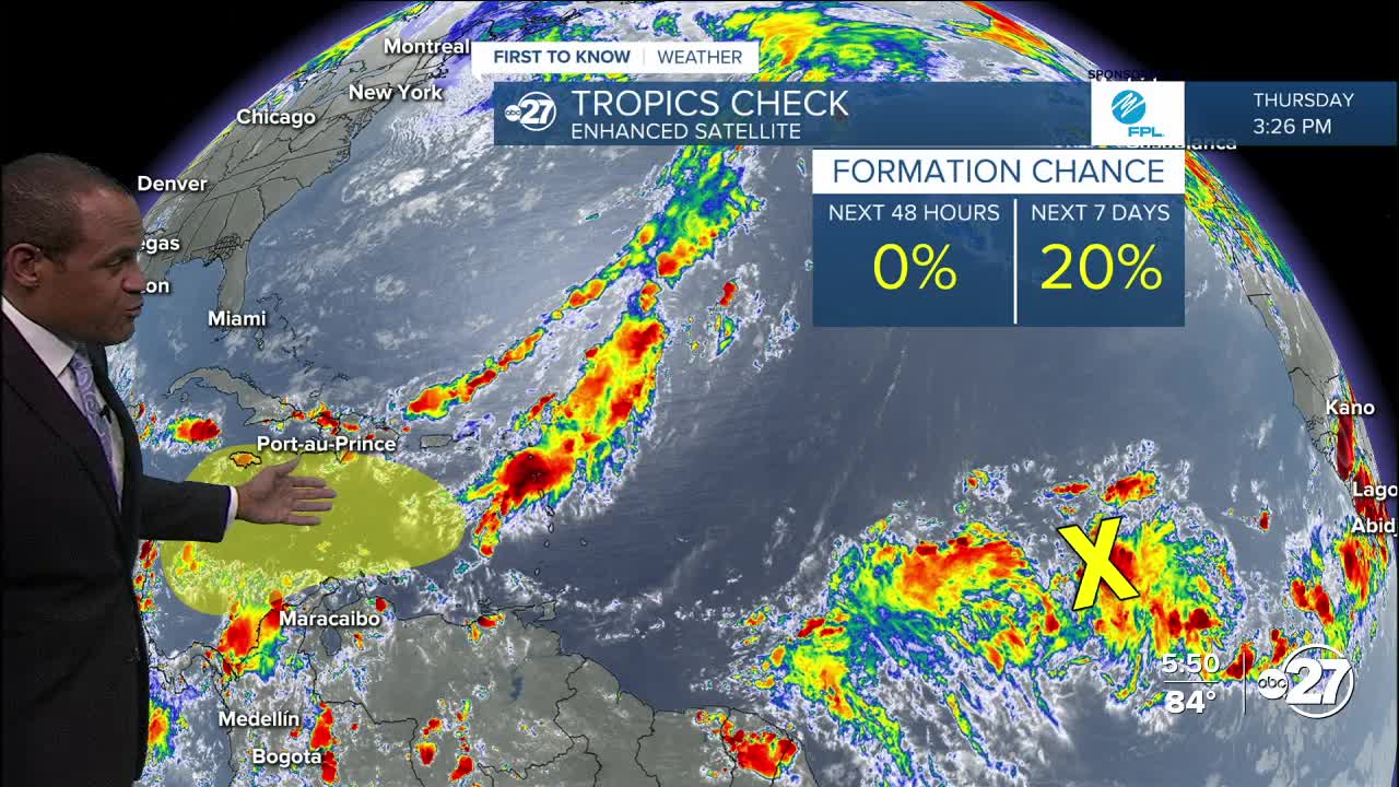
A distant tropical wave in the open lower latitudinal Atlantic is moving west, rather disorganized and over a thousand miles from the islands of the Lesser Antilles.
In the short-term, there is limited chance for the disturbance to develop. The system will run into a zone of fast upper-level winds which will disrupt its efforts to strengthen through this weekend.
The disturbance is projected to reach the Caribbean Sea about a week from now, where some long-range forecast indicators suggest better formation efforts can happen with less wind shear and very warm waters, essentially untapped by the lack of earlier systems. Projections have the system moving mainly north to northeast from there, with effects over the Greater Antilles.
Not many long-range projections — which naturally have a larger margin of error so far out — have any impacts directly in Florida, and even fewer pointing into the Big Bend or eastern Gulf.
There's no reason to have concern or worry, but late-season tropical cyclones can and do form, and we'll keep you in the know about this and any other late-season tropical storm potential that can develop in the Atlantic basin waters.
The next named storm will be called Melissa.
Want to see more local news? Visit the WTXL ABC 27 Website.
Stay in touch with us anywhere, anytime.
