


TALLAHASSEE, Fla. (WTXL) — As the former Hurricane Imelda fades over the northern North Atlantic Thursday, two other weak systems will take its place to be tracked for development chances in the days ahead.
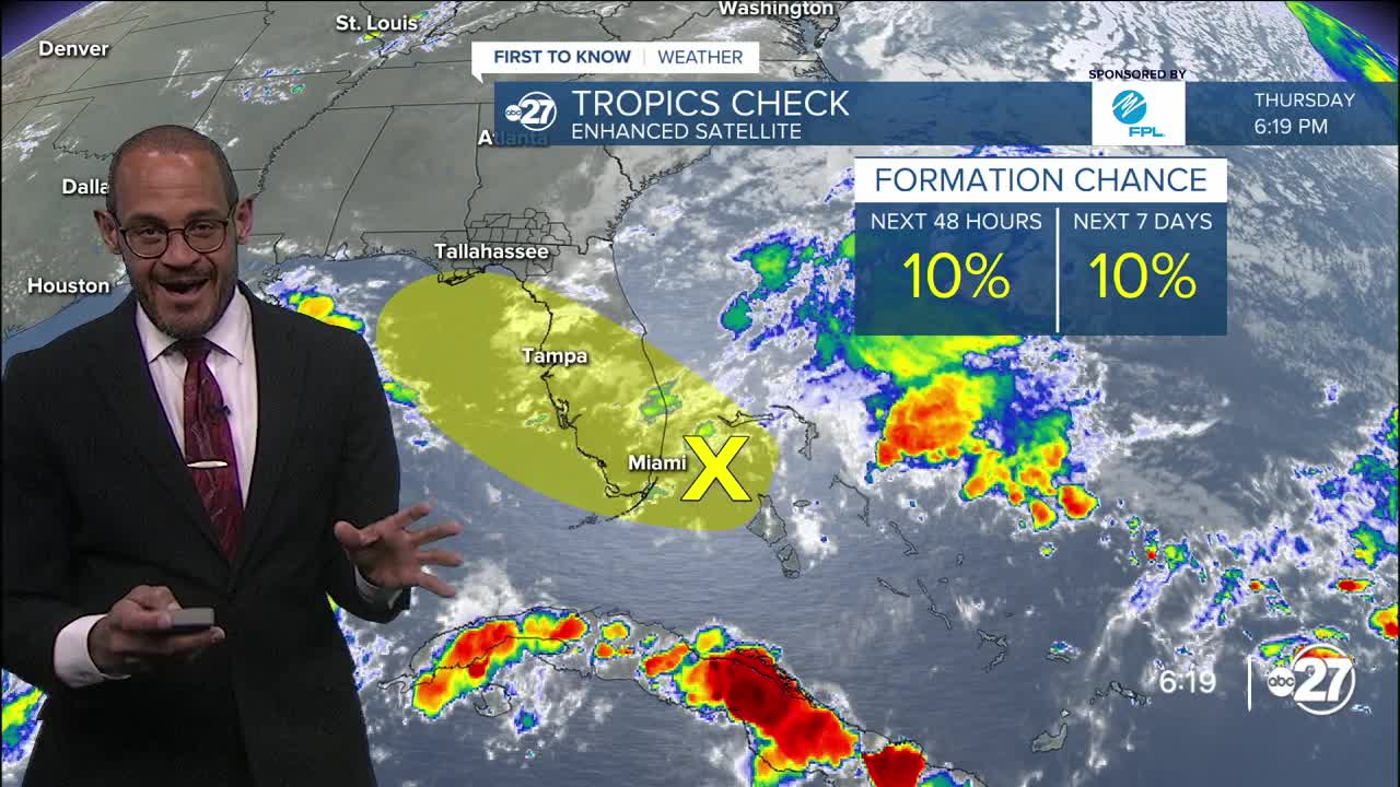
One such disturbance is highly disorganized but situated off the southeastern coast of Florida. It's embedded within a broader expanse of moisture, contributing to moist conditions near and south of Interstate 4. The disturbance is expected to move northwest across the peninsula Saturday. As it does so, it will carry its tropical moisture source with it. This will lead to more cloudiness locally in the Big Bend with better opportunities for showers, rain, and some thunderstorms. While there is an outline for development into a tropical low, a number of factors including land interaction, limited time over water, and slightly unfavorable upper-level winds will hinder any strengthening chances for the system. Additionally, none of the reliable forecast guidance models indicate robust development. The main effects encountered for areas along its path will be periodic rain which can be sometimes heavy.
A distant west African moisture source will emerge over the eastern North Atlantic waters near the Cape Verde region. It will have a long trek westward and ample monitoring will occur over the next week to 10 days or more. There is no short-term concerns for it causing issues to any land mass.
Want to see more local news? Visit the WTXL ABC 27 Website.
Stay in touch with us anywhere, anytime.
