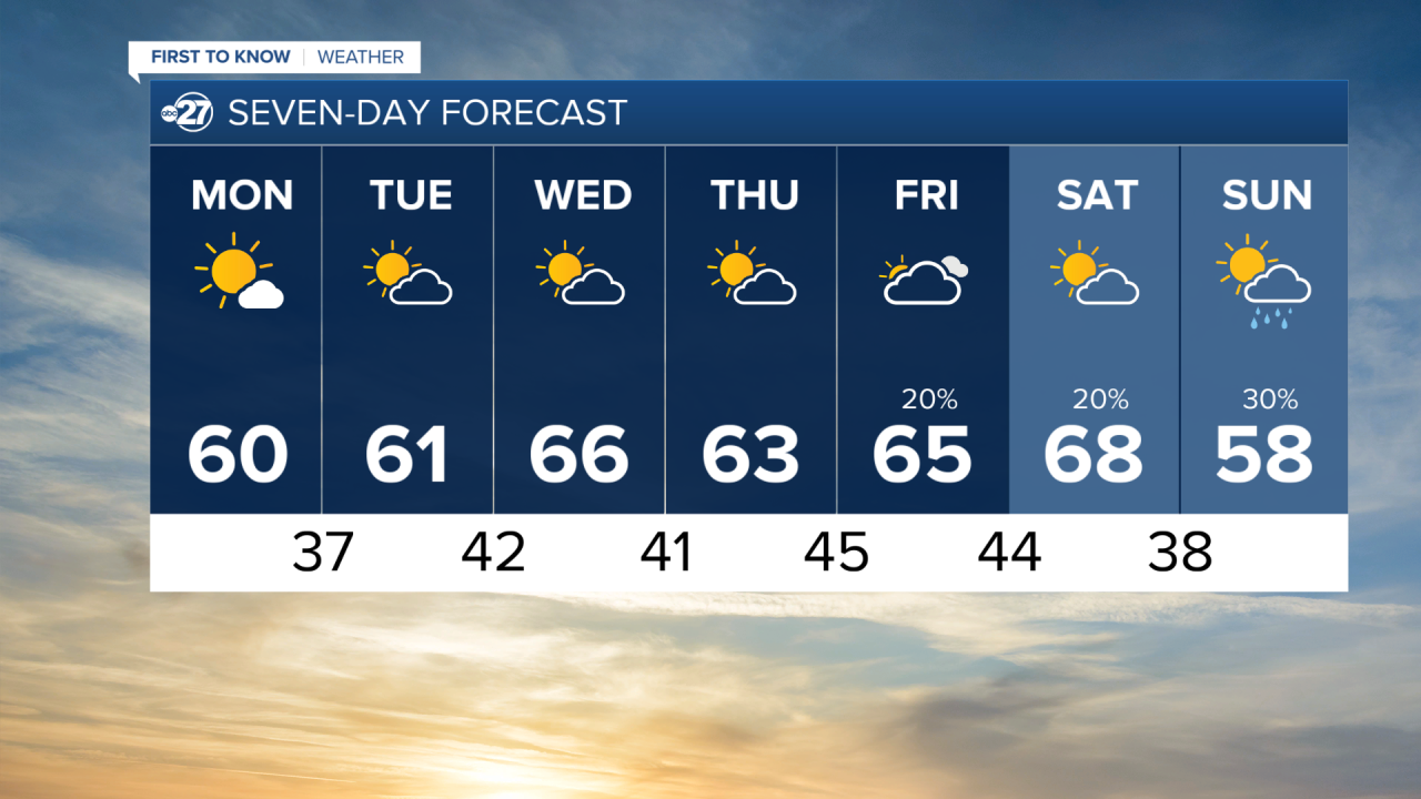
Winds out of the northwest to start the week will keep temperatures slightly below average, filtering in cooler and drier air. Monday will be the sunniest day of the week, with some passing clouds in the morning making way for abundant sunshine. Highs reach the low 60s in the afternoon as winds decrease in intensity, to around 5 miles per hour. Light winds will allow temperatures to fall steadily Monday night, and Tuesday morning will be the coldest of the week, with lows in the mid to upper 30s.

Partly cloudy skies continue for much of the week, with highs on Tuesday once again warming into the low 60s. A change in wind direction Tuesday evening into Wednesday will bring in air from more of a southerly direction, helping highs on Wednesday warm into the mid 60s. The end of the week will bring a slight chance at an isolated shower, but the vast majority of the region will remain dry.

Friday will feature mostly cloudy skies, with a low pressure system approaching from the west. This will keep the southerly wind influence and highs will once again warm into the mid 60s on Friday, and then the upper 60s on Saturday. Sunday will be the next chance at rain, with a 30% chance for showers as that low makes its closest approach to the region to our south. Cooler air will also filter into the region, with Sunday's highs expected to only reach the upper 50s. Stay tuned to ABC 27 First To Know weather for updates on the week's forecast!