


TALLAHASSEE, Fla. (WTXL) — A warm and muggy night is expected with another warm day Sunday.
Overnight lows will drop to the upper 50s to low 60s with dew point temperatures also in the upper 50s. This will make it feel slightly muggy throughout the night and fog cannot be ruled out early Sunday.
Speaking of Sunday, partly to mostly cloudy skies are expected with highs right back in the low to mid 80s. A few light showers throughout the day cannot be ruled out, but nothing to cancel plans over.
Once the late evening hours approach, a few isolated stronger showers and/or storms are possible. If any strong storms develop, the timing would be after 11 p.m.. Gusty winds are possible within isolated stronger storms. The western half of our viewing area is in a Slight (level 2 out of 5 risk) of severe weather for overnight Sunday into Monday morning with the main threats being gusty winds and an isolated, brief tornado.
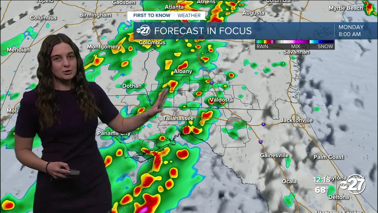
Monday morning is where we are expecting the bulk of the strong storms to arrive both ahead of the expected cold front and within the line associated with the cold front.
Isolated storms are expected to move in from the south early Monday morning (4 a.m. - 7 a.m.). These storms have the capability to quickly become strong and even severe with the main threats being gusty winds (40-70 mph), brief tornadoes, and hail. After the isolated storms is when the line of showers/storms associated with the cold front arrive. These also have the possibility of being on the strong and even severe side with the same threats as the isolated storms. The timing for this line is 8 a.m. - noon. Due to this, the entire viewing area is in a Slight risk for severe weather Monday.
It is to be emphasized that both rounds of storms reaching severe strength is worst-case scenario and is not guaranteed at this time. If the isolated storms ahead of the front eat up all of the energy in the atmosphere, the line associated with the cold front could weaken and come through as just showers. However, the chances of seeing strong storms Monday morning is increasing, so make sure you are weather aware!
Once the front passes, attention will turn to the dramatic drop in temperatures. Lows Monday night will drop to the 30s with highs struggling to reach the 60s Tuesday. Winds could be strong behind the front causing wind chills for both overnight lows and daytime highs.
Want to see more local news? Visit the WTXL ABC 27 Website.
Stay in touch with us anywhere, anytime.
