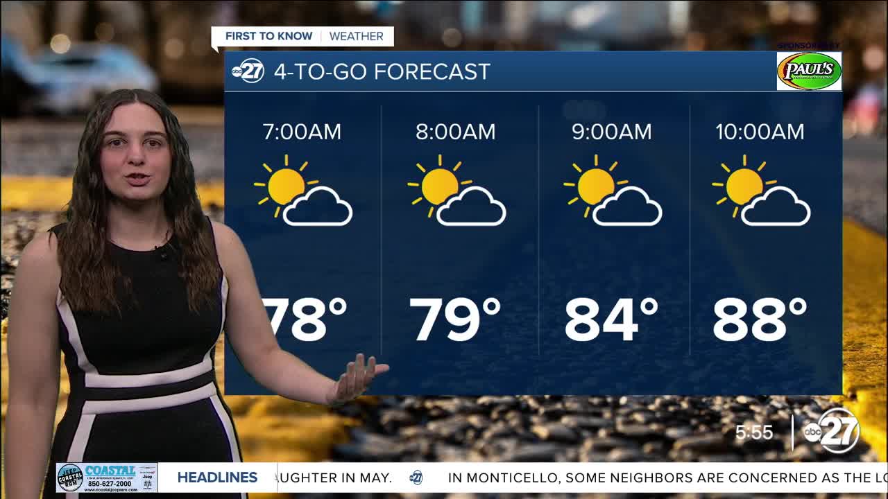


TALLAHASSEE, Fla. (WTXL) — Although highs will stick in the upper 90s Tuesday, rain will be returning to the forecast and is here to stay for the rest of the week.
As the high to our south moves out, we start to see a low move in with lots of moisture packed within it.
This moisture will pop up scattered shower and storm activity through Tuesday afternoon and linger through the week.
These storms will have the capability to dump lots of rainfall and produce gusty winds, so isolated flooding is possible.
Another heat advisory has been issued for Tuesday beginning at 11:00 a.m. and going until 7:00 p.m.. Highs will reach the upper 90s yet again with heat indices up to 111 degrees.
We will start to see our high temperatures drop back to average in the low 90s tomorrow.
Stay cool and dry!
Want to see more local news? Visit the WTXL ABC 27 Website.
Stay in touch with us anywhere, anytime.
