


TALLAHASSEE, Fla. (WTXL) — Both the humidity and above average temperatures will be sticking around for now, but a Thanksgiving cool down is approaching.
There wasn't much dry air behind the weak cold front that is continuing to provide partly cloudy skies as dew point temperatures dropped slightly to the 50s.
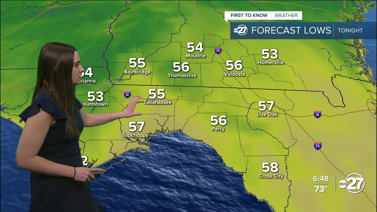
Overnight lows Sunday will dip into the mid to upper 50s and daytime highs Monday will warm back up into the upper 70s to low 80s.
We will start off the week dry before another, stronger cold front arrives just in time for Thanksgiving! This front will provide a handful of shower and storm activity Wednesday. As of right now, there isn't much indication of severe weather, but stronger storms are possible.
Once the front moves through, temperatures will drop Thanksgiving day to the 60s for highs and upper 30s and 40s for lows. A breeze is expected Thursday night, allowing for wind chills to drop to the low 30s.
Want to see more local news? Visit the WTXL ABC 27 Website.
Stay in touch with us anywhere, anytime.
