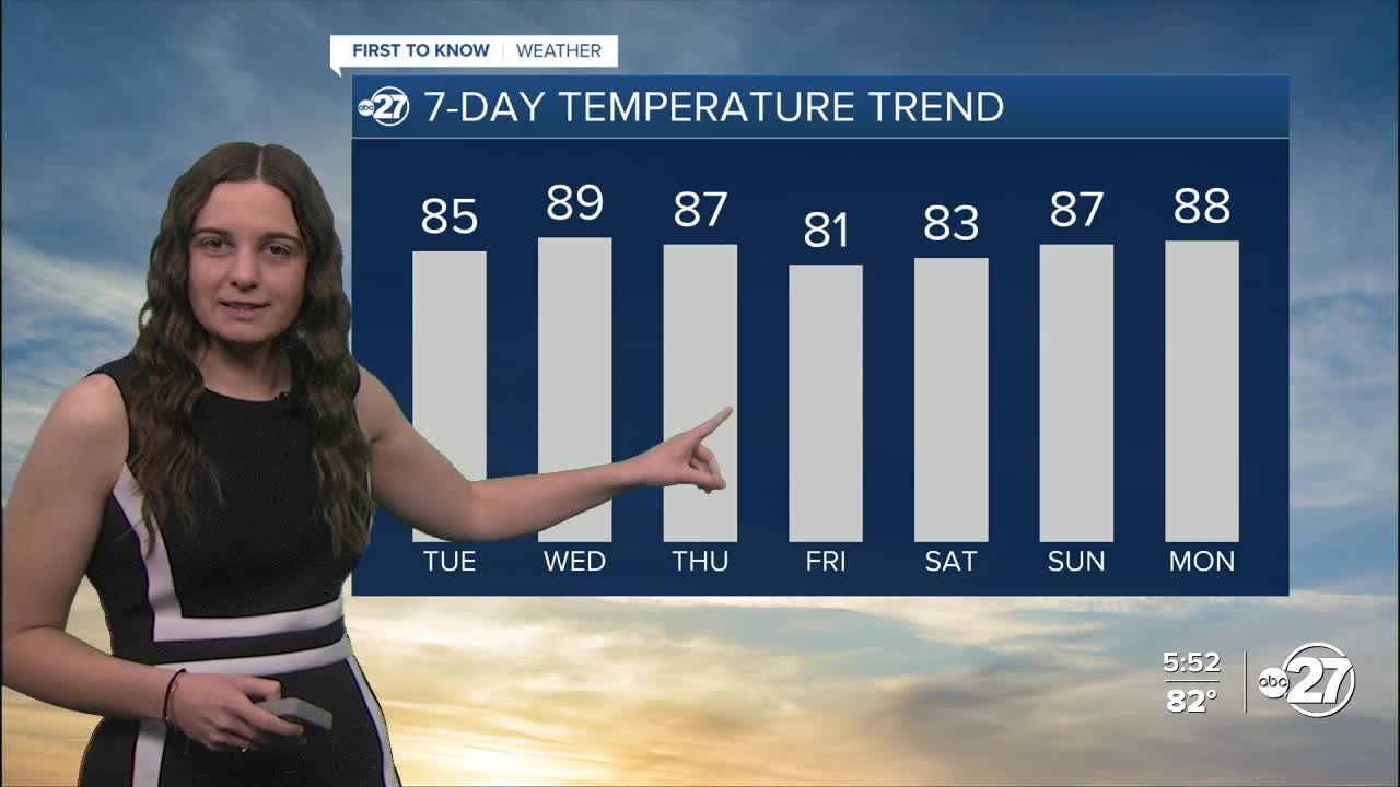


TALLAHASSEE, Fla. (WTXL) — I hope you enjoyed the cooler temperatures while they lasted because we have kicked off the warming trend!
Lows Monday night will get down into the upper 50s for most before quickly reaching the mid-to-upper 80s for daytime highs Tuesday.
We will be welcomed with sunshine yet again Tuesday morning before moisture moves in from the south and allows a few clouds to be scattered across the area.
Another cold front will approach Thursday with more rain! As the timing is still up in the air, trends are leaning towards rainfall later Thursday and throughout the day Friday. Storms are very possible with some containing gusty winds.
Depending on where the front stalls, we could see rainfall into the weekend. If it stalls to our south, we will be in the dry air behind the front and rain chances will be on the lower side. However, if it stalls overhead, then plenty of moisture will be locked in to allow for showers Saturday with isolated showers Mother's Day.
Temperatures will take a very brief dip into the lower 80s Friday and possibly Saturday before warming back up into the upper 80s come Sunday.
Want to see more local news? Visit the WTXL ABC 27 Website.
Stay in touch with us anywhere, anytime.
