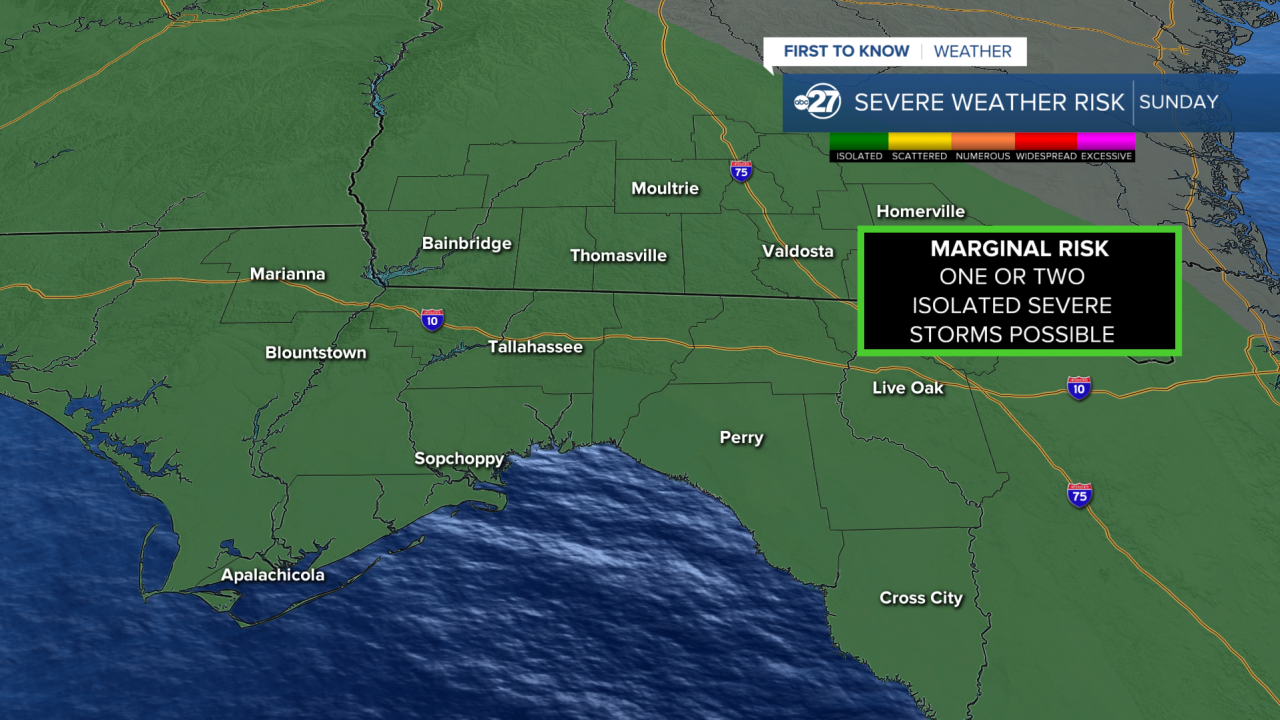


TALLAHASSEE, FL. — We are in a Marginal Risk (Level 1 out of 5) for severe weather. This means one or two isolated severe storms are possible through this event. Strong storms can start as early as 3 P.M., but the severe threat has a better chance around 8:00 p.m.. ending around 1:00 a.m. with heavy rain and lingering thunder remaining into Monday morning.
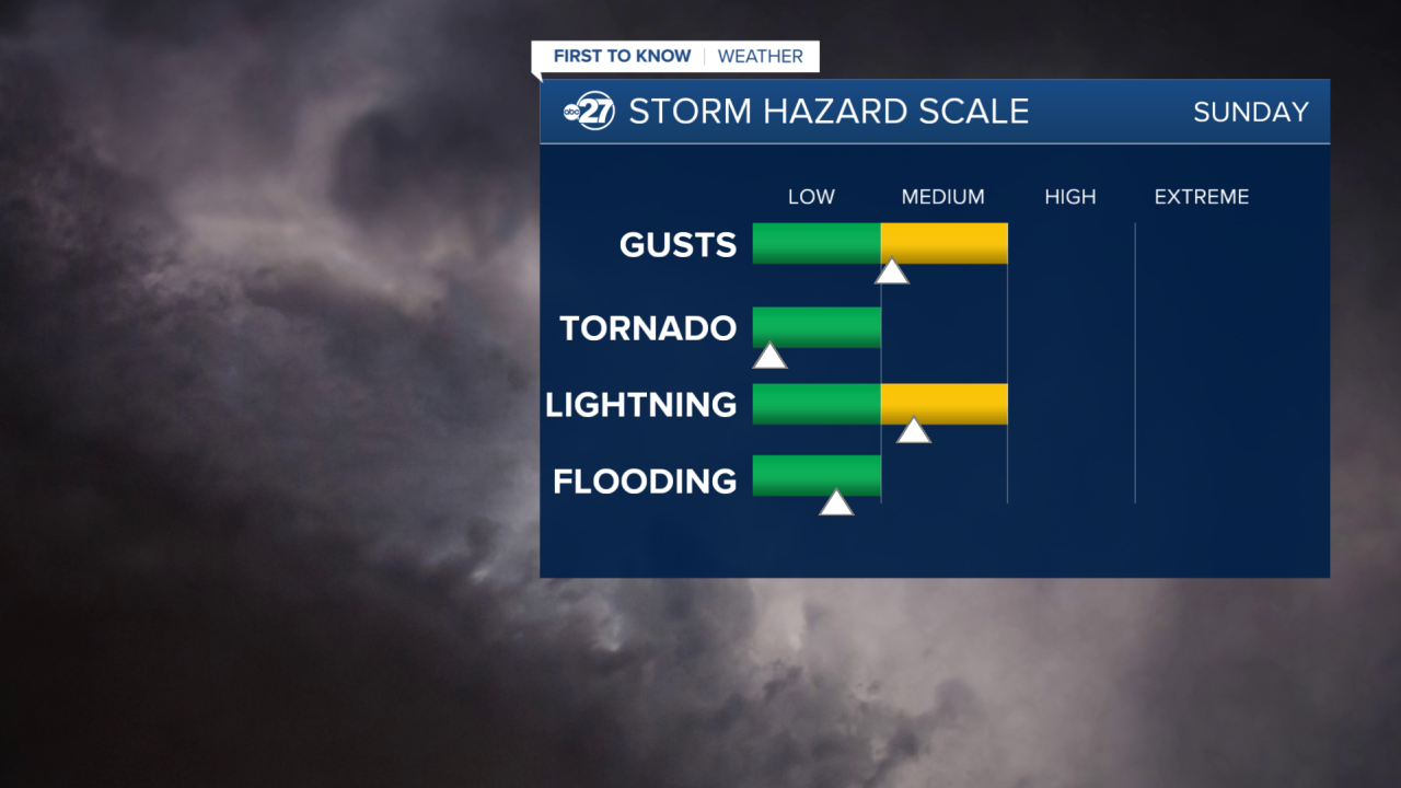
The Main Threats with this system will be Strong Gusts around 60 mph and Frequent Lightning. Other threats could include tornadoes and flash flooding, but as of now these risks are very low. We are still in an extreme drought, so the rain is desperately needed, but excessive rain can cause more damage than relief.

We are in a Marginal Risk (Level 1 of 4) for excessive rainfall. This is another way of saying Flash Flooding. The chances are low at only 5%-14%, but localized areas of flooding cannot be ruled out. Rainfall totals are estimated to be around 1"-2" by Monday morning.
This is still a changing forecast so stick with us for updates as they come.
Want to see more local news? Visit the WTXL ABC 27 Website.
Stay in touch with us anywhere, anytime.
