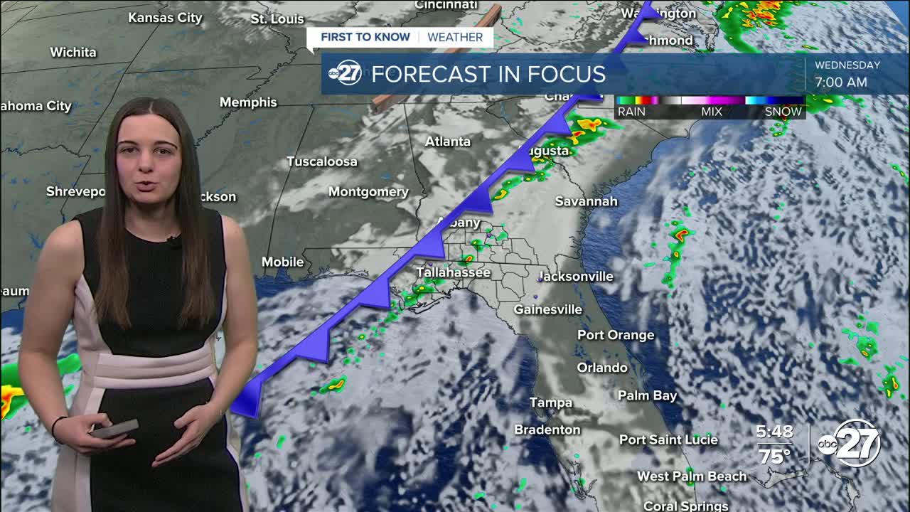


TALLAHASSEE, Fla. (WTXL) — A strong cold front will start to work its way in later tonight, providing showers and storms starting in northwestern neighborhoods and working southeast throughout the day Wednesday.
Overnight temperatures will stay above average Tuesday in the low 60s with another warm day on tap Wednesday as daytime highs will climb to the upper 70s.
The line of showers and storms will creep in starting late tonight and move east throughout the day. These storms have the capability to become strong with the main threats being gusty winds, hail, and a brief tornado or two is possible. However, the energy for the bulk of the severe weather will be staying to our northwest. So we could see an isolated severe storm or two, but for the most part, it will be the thunderstorms we are used to.
These storms won't be lasting all day as they are coming in one line. The line will take about 1-2 hours to pass through your area, and then clearing out after that.
The main story is going to be the temperatures behind the cold front. Thanksgiving daytime highs will stay in the upper 50s to low 60s and overnight lows will take a big drop into the 30s!
Stay warm!
Want to see more local news? Visit the WTXL ABC 27 Website.
Stay in touch with us anywhere, anytime.
