


TALLAHASSEE, Fla. (WTXL) — Grab those umbrellas as you head out the door! Much needed rainfall is expected to slowly move through the area Friday.
Temperature wise, we will start out in the upper 50s to low 60s, but quickly climb to the mid 70s for highs.
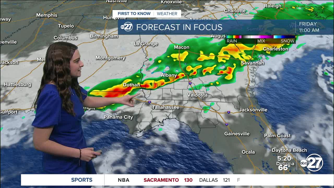
The line of showers and storms will initially approach northwestern counties as early as 10 a.m.. South Georgia will get in on a majority of the rainfall as the line is expected to slowly break apart as it moves southeast.
However, 0.5" - 0.75" of rainfall is expected with isolated neighborhoods seeing up to 1".
The storm activity won't get too strong, but gusty winds and small hail are not out of the question.
The showers will move into the Tallahassee area at around the noon hour and linger for a few hours after. Even when the showers pass, cloud cover will stick around through the night and for a majority of Saturday.
Banana Ball fans, grab an umbrella if you are heading to the game Friday night! Although a majority of the shower activity will be gone, a few lingering showers are possible throughout the game.
Saturday's match up between the Savannah Bananas and Texas Tailgaters is looking shower free as of now, but partly cloudy conditions are expected.
Although it is a cold front providing the rainfall, temperatures will not drop behind the front. We will stay warm through the weekend with highs well into the 70s, eventually a few 80s will pop up come Monday.
Want to see more local news? Visit the WTXL ABC 27 Website.
Stay in touch with us anywhere, anytime.
