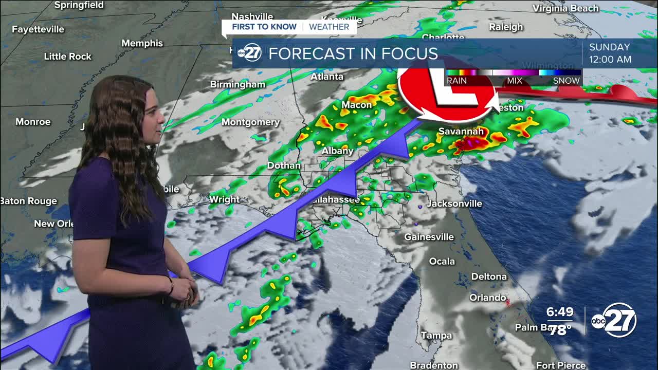


TALLAHASSEE, Fla. (WTXL) — Cloudy conditions continue through the rest of the evening as we wait for the showers and storms.
The cold front is making its way closer and will slowly push through overnight Saturday. Along with it, showers and storms. They will be light to moderate to start throughout the evening, but pick up as we move through the night.
There is a possibility for isolated storms to become severe with a Marginal (1 out of 5) risk in place. This threat is mainly for south Georgia, but storms could trickle into parts of the Big Bend. The main threats would be gusty winds (40-60 mph) and small hail. There is a slight chance for a brief tornado, but that remains very low.
Once the front passes, our attention will turn to the colder temperatures and fire risk. A Red Flag Warning is in effect from 1 - 7 p.m. Sunday for the following counties:
- Liberty
- Franklin
- Wakulla
- Leon
- Jefferson
- Madison
- Taylor
- Hamilton
- Suwannee
- Lafayette
- Clinch
- Echols
Breezy and very dry conditions are expected which could allow any fires to spread quickly. Winds are expected to be sustained between 15-20 mph and dew points will drop to the 20s and 30s.
Highs will stay in the 60s Sunday with overnight lows dropping back to the 30s Sunday night and some neighborhoods will see the 20s come Monday night.
Want to see more local news? Visit the WTXL ABC 27 Website.
Stay in touch with us anywhere, anytime.
