


TALLAHASSEE, Fla. (WTXL) — Lingering moisture across the area will help fire up showers and storms across the area Friday as a front remains in place.
Cloud cover will fill the skies today with a few isolated pockets of sunshine, mainly for southeastern neighborhoods in the Suwannee River Valley. Those in Bainbridge and surrounding areas will keep highs in the upper 70s to low 80s while temperatures increase as you travel east and south into the mid 80s.
A stationary front stalled out along the coast line is providing plenty of moisture for showers and storms to pop up throughout the day Friday. For Friday, the highest chance for activity would be in the evening hours, however, showers will be sprinkled in throughout the day.
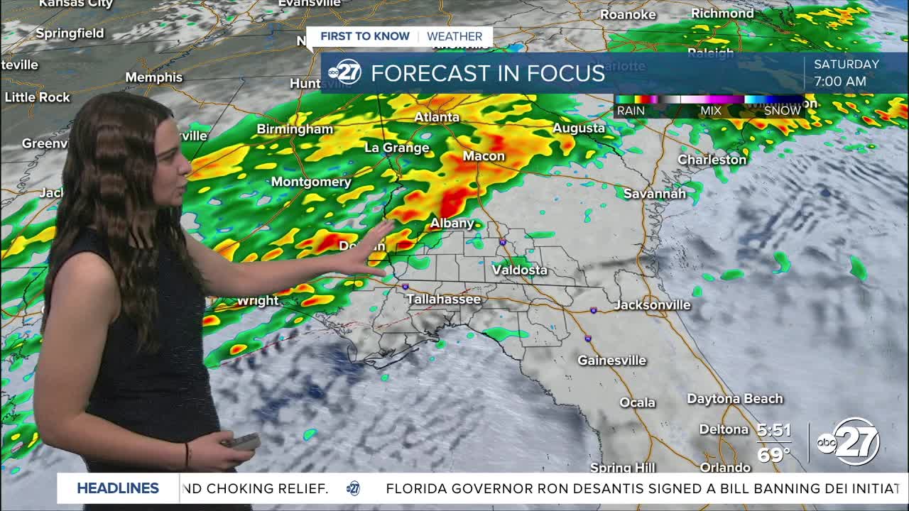
A low will ride eastward along the front into Saturday as the front lifts north as a warm front. This will set warm and moist air in place. So, as the low moves east with an unstable environment in place, the chances for stronger storms increase into Saturday morning and afternoon. The low will drag a cold front with it which will pass through throughout Saturday and will also be a driving factor for storms.
Western parts of our area are currently in a Marginal (1/5) risk for severe weather Friday with the main risk being gusty winds and small hail.

A majority of the Big Bend and parts of south Georgia are in a Slight (2/5) risk for severe weather Saturday. The threats include gusty winds, hail, and isolated tornadoes.

Outdoor plans Saturday should be ready to move indoors as the activity will linger throughout a majority of the day.
Everything will clear out by Sunday, even the cloud cover, and temperatures will stay cool as the sunshine returns.
Want to see more local news? Visit the WTXL ABC 27 Website.
Stay in touch with us anywhere, anytime.
