


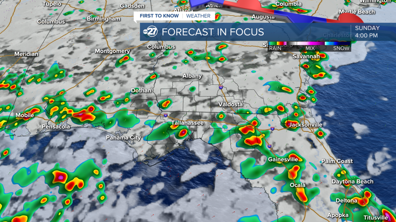
TALLAHASSEE, Fla. (WTXL) — A Marginal (level 1 out of 5 risk) risk for severe weather is in place for Sunday as isolated severe storms are possible mainly through the afternoon hours. A moist air mass is already in place and a cold front will begin to drift south towards the area packing plenty of moisture and activity with it.
The main hazards associated with the strong to severe storms are gusty winds (60 mph), frequent lightning, and heavy downpours.
Any outdoor plans should have back ups as storms will be in the scattered to numerous variety.
Storms could start popping up as early as noon - 1 p.m., becoming stronger throughout the afternoon.
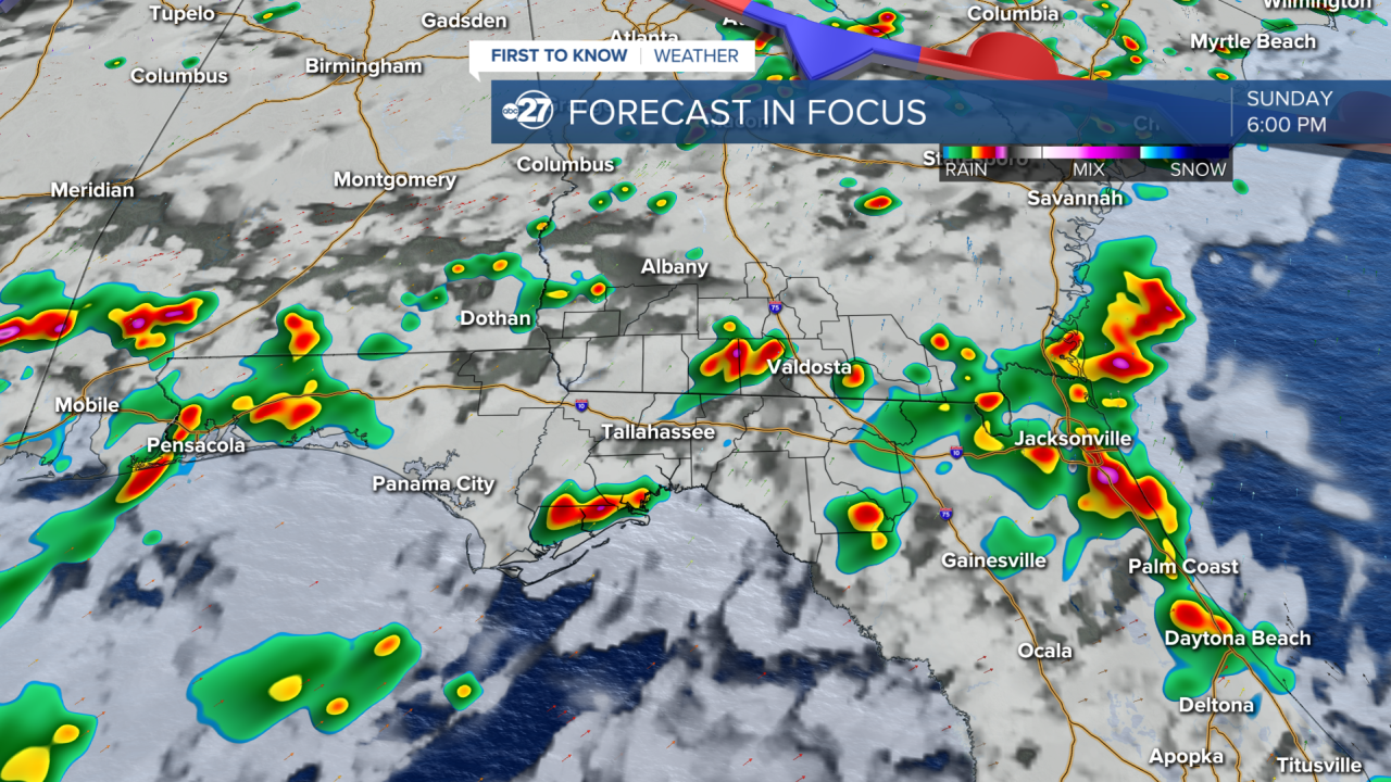
The front will continue to move across the area through Tuesday, so increased rain coverage is expected through midweek.
Want to see more local news? Visit the WTXL ABC 27 Website.
Stay in touch with us anywhere, anytime.
