


TALLAHASSEE, Fla. (WTXL) — A Severe Thunderstorm Watch has been issued for our southern Georgia counties until 4:00 am Thursday.
A cluster of thunderstorms containing strong and severe wind gusts will travel from the Carolinas through middle and south Georgia in the pre-dawn hours.
These storms will cause occasional wind gusts upwards of 60 mph, along with frequent lightning, loud thunder, and downpours.
Hail is also possible. The risk for tornadoes is near zero.
Nonetheless, damaging straight-line winds are particularly hazardous at night. Have multiple reliable ways to get alerts for warnings as the line of storms moves through.
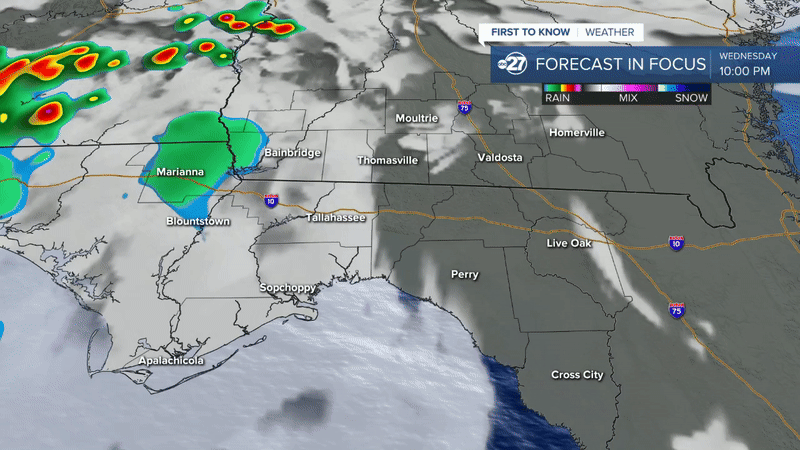
Our Forecast in Focus depicts this batch of thunderstorms reaching interior southern Georgia counties (such as Berrien) as early as 2:00 am, steadily moving toward the state line by 4:00 a.m. Some weakening is anticipated beyond 4 a.m. as what's left of the storm complex slips southwestward into the Florida Big Bend and I-10 regions.
Power outages are also possible, so make sure all electronic devices are charged.
Want to see more local news? Visit the WTXL ABC 27 Website.
Stay in touch with us anywhere, anytime.
