


TALLAHASSEE, Fla. (WTXL) — The cool season's latest cold front in the Florida/Georgia state line area will cause another damper for the weekend. However, it's forecast to steadily move in and out of the local neighborhoods during the course of Sunday morning and afternoon.
Saturday will be variably cloudy with periods of sunshine mixed in during the daytime hours. Brief showers are possible in the Apalachicola River and tri-state regions, but they are expected to be temporary and low-impact.
Times of steadier rain will be renewed when the cold front comes closer starting Sunday. Some of the rain will fall on already soggy ground from last weekend's deluges. Spots of ponding and nuisance flooding is possible in areas where rainfall is heaviest. As of Friday evening, rain total forecasts range from one to two inches in most areas.
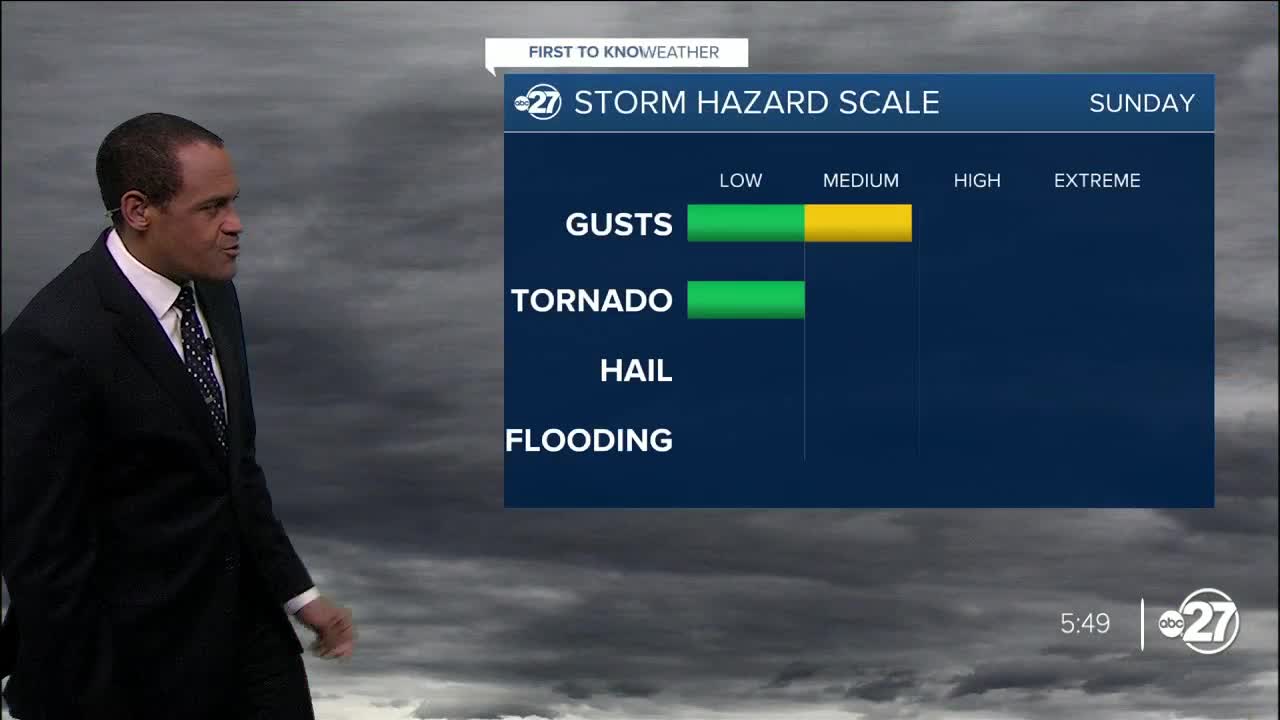
Severe thunderstorm risks are low, but non-zero. One concern will be from gusty winds ahead of the front. Breezes will increase from the south late Saturday night, reaching about 10 to 20 mph with gusts of 30mph or so along the coast and offshore.
Individual areas of storms can form early Sunday morning off the Emerald and Forgotten coasts, moving toward the shore. A couple of those areas can create stronger gusts and a chance for waterspouts.
The main line of rain and storms will progress from west to east Sunday morning through mid-afternoon. While the timing of this activity will be adjusted with new data, the storms will bring generally stronger wind gusts around 35-45 mph. A few can reach severe levels of 60mph for a brief time. The most substantial rain action is forecast to exit the region by late Sunday afternoon or early evening.
Advisories or warnings related to flooding, severe storms, tornadoes, or marine weather hazards would be issued if these hazards are noticed.
First to Know Weather will keep you connected to reliable, no-hype weather information and forecasts throughout the weekend.
