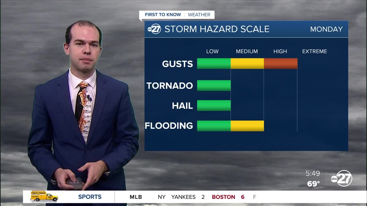
TALLAHASSEE, Fla. (WTXL) — Two rounds of storms will make their way into our area today, one in the morning, the other in the mid-to-late afternoon. The first round of scattered storms moving into our area this morning is moving in now through noon. It will bring the chance for severe weather in the form of damaging winds, small hail, and an isolated tornado. Saturated ground from multiple days of rain may cause flooding in areas that pick up heavy rain from today's storms, so remember to turn around, don't drown if you encounter a flooded roadway. Cloud cover will be widespread throughout the day, helping to keep high temperatures in the upper 80s. Later this afternoon a second wave of severe storms will make their way through the region from 3pm past sunset. The same severe threats are possible, and these storms may be slightly stronger than the storms this morning. Overnight, temperatures will fall into the low 70s before we warm up into the low 90s for the day tomorrow. I expect to see more sunshine tomorrow, but there will still be the chance at some scattered storms. The wet pattern continues throughout this week.


Posted
and last updated
