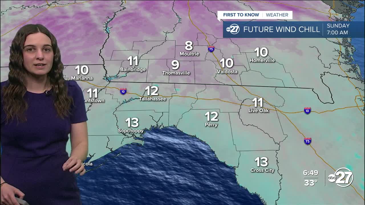


TALLAHASSEE, Fla. (WTXL) — The coldest air is moving in and will settle in overnight. Temperatures will quickly drop to the 20s and eventually the teens for some, but once the winds are factored in, wind chills will be well into the teens and single digits.
Winds overnight will be sustained at 10-15 mph and gusting to 20-30 mph. The strong winds are what is going to make it feel like single digits early Sunday morning.
Both an Extreme Cold Warning and Freeze Warning are in place for everyone across the Big Bend and south Georgia. The Extreme Cold Warning is in effect until 1 p.m. Sunday due to wind chills as low as 9°. The Freeze Warning starts at 7 p.m. Saturday and expires at 10 a.m. Sunday due to a hard freeze and temperatures as low as 20°.
The winds will stick with us through Sunday, making our highs of the low 40s feel more like the 30s throughout the day. Another drop to the 20s is expected Sunday night before we gradually and briefly warm up mid-week before another front comes through and drops temperatures again, but not as significant as the current temperatures.
This front is likely to bring showers throughout the day Wednesday and early Thursday.
Want to see more local news? Visit the WTXL ABC 27 Website.
Stay in touch with us anywhere, anytime.
