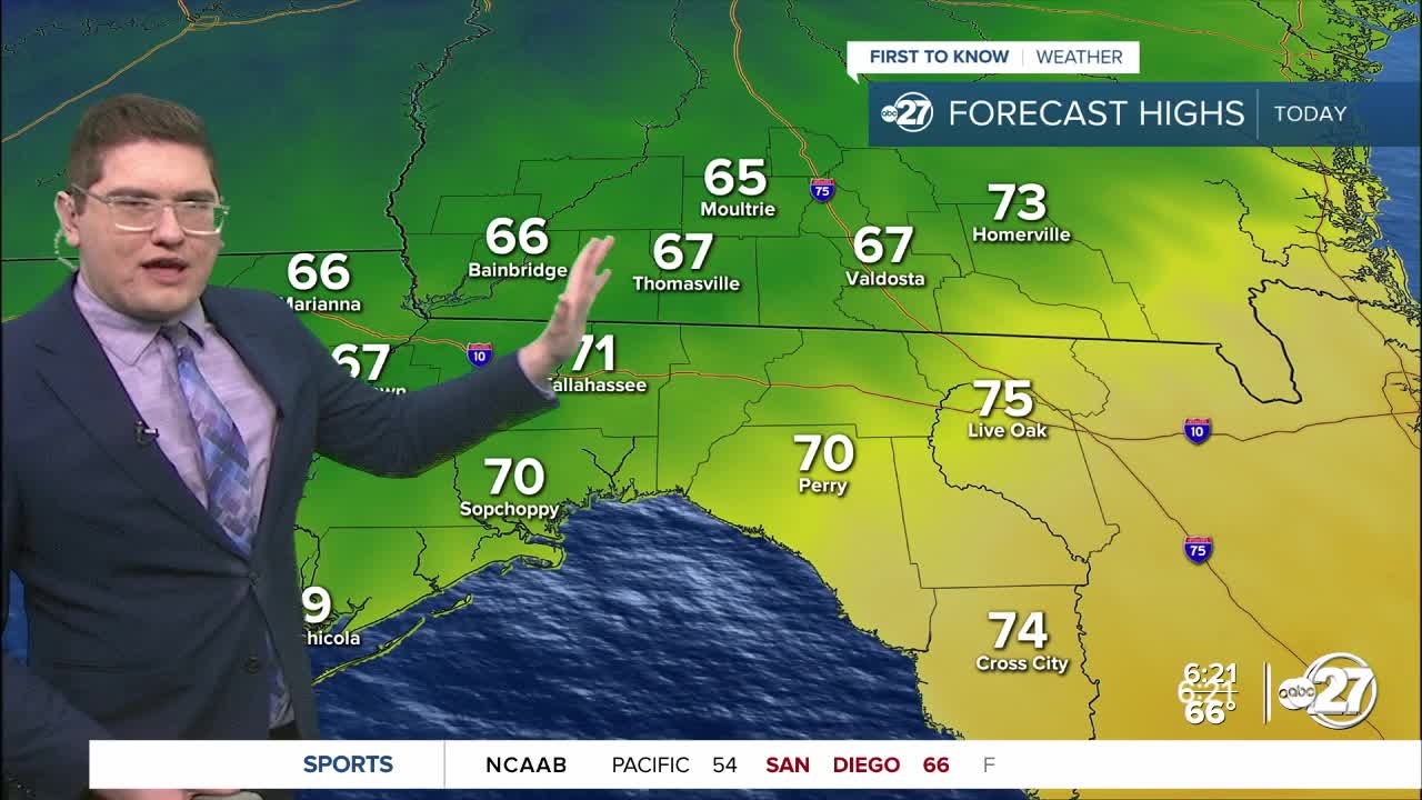


TALLAHASSEE, FL. — Today will be the last warm day of 2025. We start off humid and in the mid to low 60s this morning. Patchy dense fog will be possible, focusing along the coastline and our southeast counties. Highs will only reach the low 70s and upper 60s before the front pushes through.
There are scattered showers associated with this cold front. They will be weak with a low chance for thunder pushing through from 9am to 1pm. Rainfall totals are expected to be around a tenth of an inch or less. The winds pick up in the afternoon as the front passes. Sustained winds will be from the northwest from 10-15 mph, and gusts could reach up to 25 mph.
The biggest impact from this front, will be the sharp drop in temperature. We are starting off today in the mid 60s, but tomorrow we will start in the low 30s. We could get even colder to start New Years Day. With the steady breeze remaining overnight, the wind chills could reach the teens in some areas. Our morning lows will likely not warm back to average or above average until the end of the week.
Want to see more local news? Visit the WTXL ABC 27 Website.
Stay in touch with us anywhere, anytime.
