


TALLAHASSEE, FL. — Storms and rain are the story for the rest of the day today.
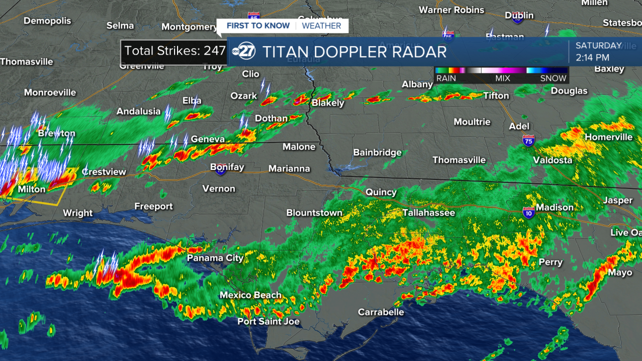
Heavy rain started around 7 A.M, beginning as scattered showers, and becoming a line of stratiform rain just before midday. We had 1"-2" already fall, and at least another half inch is on the way. This is a good thing when it comes to the threat of storms for this afternoon. When rain falls it stabilizes the atmosphere. When the air is unstable that fuels storm development. Instability is formed from heat which lifts air from the surface into the atmosphere where it condenses into clouds and eventual rain and storms. When water evaporates it cools a given area, with the amount of rain we had our atmosphere is much cooler and therefore more stable. This does not mean we will be free from storms or even severe storms. It does mean that storms will need to use a lot more energy to strengthen, which for us reduces the threat for severe activity. The front itself is now the only fuel to the storms, instead of the unstable air the front would be pushing through.
The storms will start to push through our area around 3 P.M. We are anticipating fewer severe storms because of this early rain, but one or two can still pop up. At the very least general storms will still push through, so it will get loud and breezy this afternoon and evening. The worst of the rain will end by 7 P.M. with lingering showers until around 11 P.M. Then the skies clear over the course of Sunday.
Stick with us as we learn more about the coming storms.
Want to see more local news? Visit the WTXL ABC 27 Website.
Stay in touch with us anywhere, anytime.
