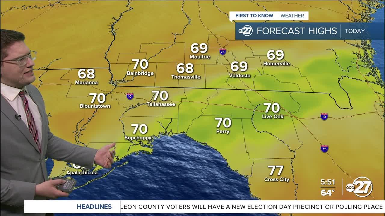


TALLAHASSEE, FL. — We are starting the day off in the 60s. Some 50s will dot the area as the cold front, and low pressure, moves through. Scattered showers will become more widespread rain as the sun rises, and could last until the sun sets.
By midday temperatures will remain in the 60s, likely cooling through the afternoon instead of warming up. Showers will linger into the night and possibly even to start Tuesday, but skies will clear up through the afternoon.
The air behind this front will be drier with very windy conditions. Gusts could reach above 25mph+ with sustained winds as highs as 20 mph from the northeast. Despite Tuesday starting with some rain, the humidity will plummet bringing us back into a fire weather watch.
Want to see more local news? Visit the WTXL ABC 27 Website.
Stay in touch with us anywhere, anytime.
