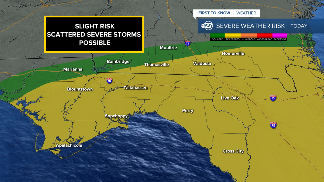


TALLAHASSEE, FL. — Good news this Saturday morning. While storms and rain cover most of the Big Bend and South Georgia, the threat of severe weather seems to be lowering. While we are still in a Slight Risk (level 2 out of 5) most of the storms coming off the gulf are breaking up and weakening as they cross over land. It will be a loud and wet morning, but it will likely be not as severe as it could be.
Consistent rain from yesterday evening through the overnight hours have stabilized the atmosphere. Unstable air is the fuel severe storms use. When there is consistent cooling rain, that lowers the convective aspects of atmosphere, lowering the threat for severe weather. That being said a severe storm or two can still pop up, but they shouldn't be nearly as frequent, or as numerous as previously expected.
This means that our shift of concern will go from a mainly severe storm and tornado situation, to more of a flooding situation. We already have over 2" in some areas, with even more rain on the way. While this is desperately needed, there is such a thing as too much rain.
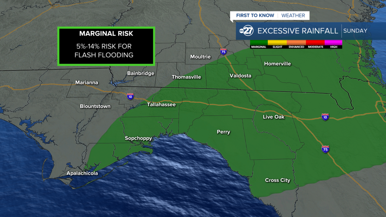
We are in a Marginal Risk (level 1 out of 5) for Flash Flooding. The general flood risk should be low as that is typically associated with rivers, streams, and lakes. These areas are already low due to the exceptional drought. The flash flooding risk will be for low lying areas where rain water can pool due to poor drainage.
Overall this should be the best possible outcome we could have gotten with this situation. Rainfall is expected to be around 2"-4" total from yesterday today. We would still need two or three days like this to get back to where we should be in terms of our rain deficit.
Want to see more local news? Visit the WTXL ABC 27 Website.
Stay in touch with us anywhere, anytime.
