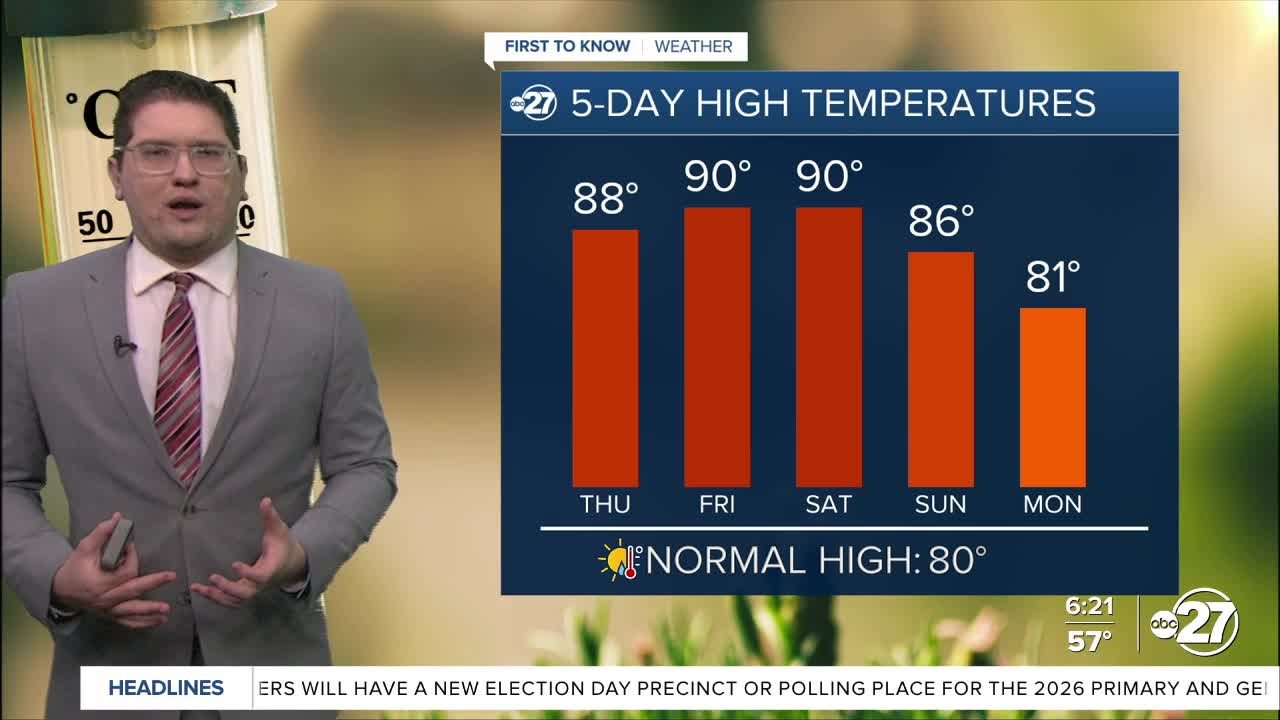


TALLAHASSEE, FL. — It is the same old same old today with temperatures starting off in the low 60s and mid to upper 50s. The skies will have some cloud coverage to start, but generally today will be a mostly sunny day. Patchy fog is dotting the areas, with isolated pockets that could be dense. These will start to lift around 9 A.M.
This afternoon is very warm once again. Yesterday we were in the upper 80s and low 90s and today will be no different. Tomorrow and Saturday are really when the heat reaches its peak. Tallahassee could break or match records for Friday, and be near records Saturday. Chances are high that other spots in our area could be close to records too.
When it comes to rain, the chances are very low. A cold front Sunday could have an isolated shower, but nothing that can help fight the drought. We are keeping an eye on next week which does have potential, but it is too soon to say anything definitive.
Want to see more local news? Visit the WTXL ABC 27 Website.
Stay in touch with us anywhere, anytime.
