


TALLAHASSEE, FL. — Another mild start to the day today. Temperatures will be in the low to upper 50s, with a few 40s in certain spots. Watch out for spots of fog this morning, in fact more will form over the next few hours. The fog will clear around 9am.
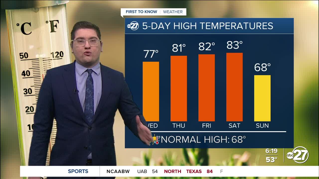
The moisture and heat from the gulf are flowing in as we speak, and it will continue to build until this weekend. This is why we could see record heat tomorrow through Saturday. Wet air holds heat better than dry air, and we are layering tropical heat on top of that. This means both the mornings, and the afternoons will be unseasonably warm. The humidity will also reach spring time levels.
This will all change heading into next week. A cold front will sweep through the area Sunday, bringing temperatures down back below average. In fact we could go from record heat these next few days, back to freezing for some mornings during the next work week. Trade those short sleeves and shorts for heavy coats, because we will need them starting Monday.
Want to see more local news? Visit the WTXL ABC 27 Website.
Stay in touch with us anywhere, anytime.
