


TALLAHASSEE, FL. — The moisture buildup has led to a foggy start this morning. The fog will be patchy, but some areas could see visibility drop to zero miles.
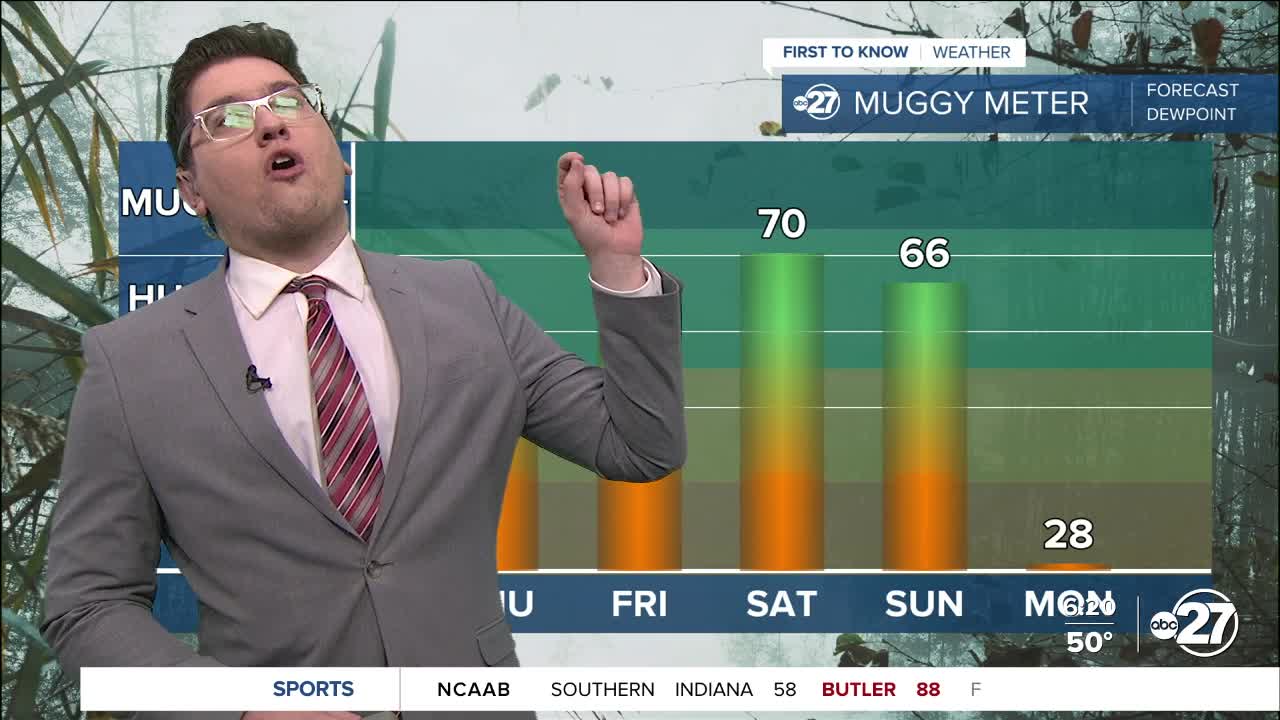
Moisture will continue to build through the day and into the weekend. Humidity levels may reach muggy conditions by Saturday, before storms and rain move in ahead of a cold front. Afternoon temperatures will be in the low 80s and will remain there until the front passes. Morning lows will also get warmer, eventually reaching the low 60s—much like summertime conditions.
This frontal passage could bring a few isolated storms, some of which could be strong. The big story, however, will be what happens afterward: unseasonably cold air will spread through both the Big Bend and South Georgia. There is a decent chance that part of our area could be under a freeze warning early next week.
Want to see more local news? Visit the WTXL ABC 27 Website.
Stay in touch with us anywhere, anytime.
