


TALLAHASSEE, FL. — Today will be a day much like yesterday.
We start off in the low 40s to low 50s, with a few 30s scattered around. The colder the areas are the denser the patchy fog will become. This is because as the air temperature cools to meet the dew point temperature (A measure of the moisture in the air) the air condenses forming fog. This will start to lift around 9 A.M. leading to mostly sunny and partly cloudy skies.
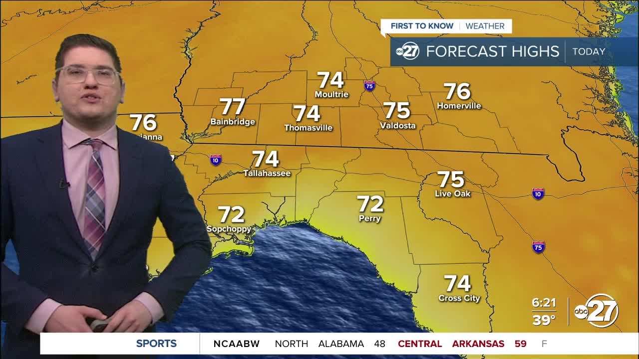
Temperatures this afternoon will be even warmer than yesterday, in the mid 70s. We wont be anywhere near record heat for the day, but it is still unseasonably warm. Skies will remain mostly sunny to partly cloudy all day long.
A slow moving and weak cold front will push through tomorrow. This will bring more clouds, and even some scattered showers. Rainfall totals will likely be at most a quarter of an inch. While we typically get cooler air behind a front, this is weak enough to only dip temperatures down from mid 70s to low 70s. A larger cold front is coming this weekend, so stick with us for those details.
Want to see more local news? Visit the WTXL ABC 27 Website.
Stay in touch with us anywhere, anytime.
