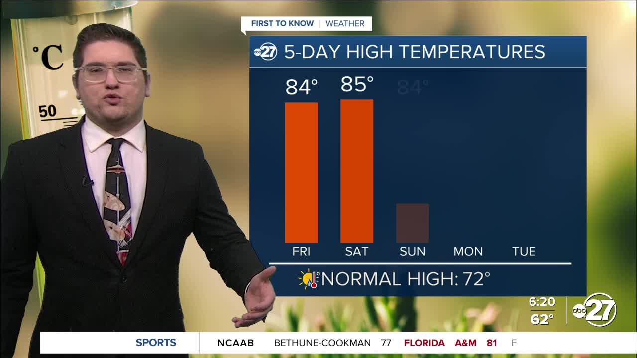


TALLAHASSEE, FL. — This morning will be like many of the others: we are warm in the low to mid 60s, it feels muggy, and there is patchy dense fog across our area. The fog will lift around 9 A.M. and we warm into the low to mid 80s once again for this afternoon. Much like yesterday there will be a mix of sun and clouds, but also a chance for spotty showers. Some thundershowers could also form, but these like the showers, will be brief.
This weekend, will be a lot like the last few days. Afternoons will stay in the mid 80s and mornings will be in the low 60s. Fog is still possible as the moisture will not leave our area just yet, but there is an end date on the horizon. Despite a chance for more spotty showers, outdoor plans wont need to be canceled, just make sure you stay hydrated.
We are keeping an eye on a cold front Thursday/Friday. This will bring significant changes as well as some storms. While it is too soon to know if things will be severe, there is enough energy for general or strong storms at this time. After the front passes we will cool down and dry up, feeling like our typical March before spring starts.
Want to see more local news? Visit the WTXL ABC 27 Website.
Stay in touch with us anywhere, anytime.
