


TALLAHASSEE, FL. — It is the same old same old out there today. We start off in the low 60s to mid 50s, with some areas even warmer. Patchy fog is possible, but wont be as widespread as yesterday.
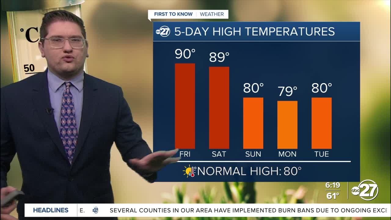
Temperatures this midday will be in the low 80s and skies will be mostly sunny, that much has not really changed. What has changes is the heat for the late afternoon. We have been in the upper 80s lately, but we could reach 90 in Tallahassee which would match the record set in 2006.
The heat will peak today, and tomorrow it will level off. We will likely not match a record Saturday anymore, but we will still be close. Sunday brings a cold front, which means cloudier skies and isolated showers. This will likely begin a closer to average trend to start the next work week.
Want to see more local news? Visit the WTXL ABC 27 Website.
Stay in touch with us anywhere, anytime.
