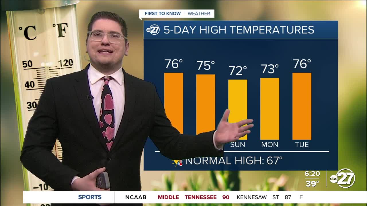


TALLAHASSEE, FL. — Today is going to be an amazing day, but make sure you grab your jacket as you head out the door. Temperatures this morning will be in the low 40s and upper 30s. We do warm into the mid and upper 70s again this afternoon, so you can put those jackets aside as you head out to lunch. The skies will remain mostly sunny all day long.
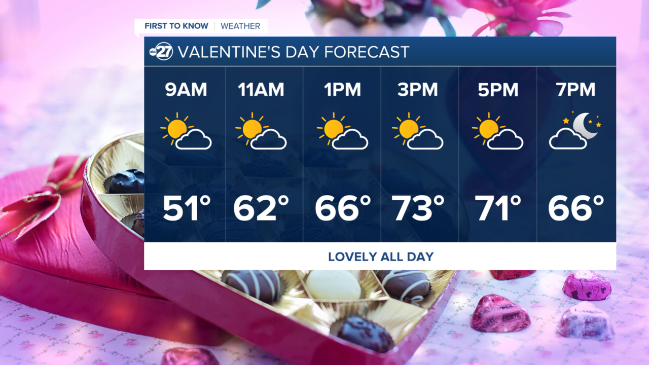
Valentine's day, looks relatively the same as today, except with more clouds. The drier air is keeping us cooler in the morning, but the sun is allowing us to cook up into the mid 70s by around 4pm. This will be perfect for both indoor and outdoor plans all day Saturday!

Changes do come for Sunday. Scattered showers are possible from sunrise to sunset, with a high chance of strong storms. The current timing of the even will be in the evening and overnight. Models are still inconsistent with the exact timing, so stick with us for updates as they come, as of now they are expected to start around midnight, and could end Monday around 6AM.
We are in a marginal risk (level 1 out of 5) for severe weather. This means isolated severe storms can develop. The main threats with this system will be strong wind gusts (around 60 mph) and a small chance for flash flooding (5%-14% chance). We do need this rain however, since we are still in an extreme drought.
Want to see more local news? Visit the WTXL ABC 27 Website.
Stay in touch with us anywhere, anytime.
