


TALLAHASSEE, Fla. (WTXL) — One week ago, we were struggling to get cool, with temps near 100°.
Now, it's a little more difficult to find prolonged sunshine, and temperatures are lower as a result.
With the additional clouds stretched across most of the region, evening readings will be in the 80s, falling into the 70s later. Times of passing rain and thunder will contribute to a fast temperature drop when those conditions are encounters in various neighborhoods.
Overnight, it will be mainly cloudy with a few more showers and lows in the mid to lower 70s.
Tuesday, the stalled front and upper-level disturbance to our northwest will maintain their presence in our region, allowing for more cloudiness, peeks of daytime sunshine, and times of showers and storms, especially in the tri-state counties and through the US 319 corridor. It won't rain all the time, but areas can get more than one dose of showers and rain throughout Tuesday. Highs will be in the upper 80s to lower 90s, warmest in areas with more sunshine to the southeast.
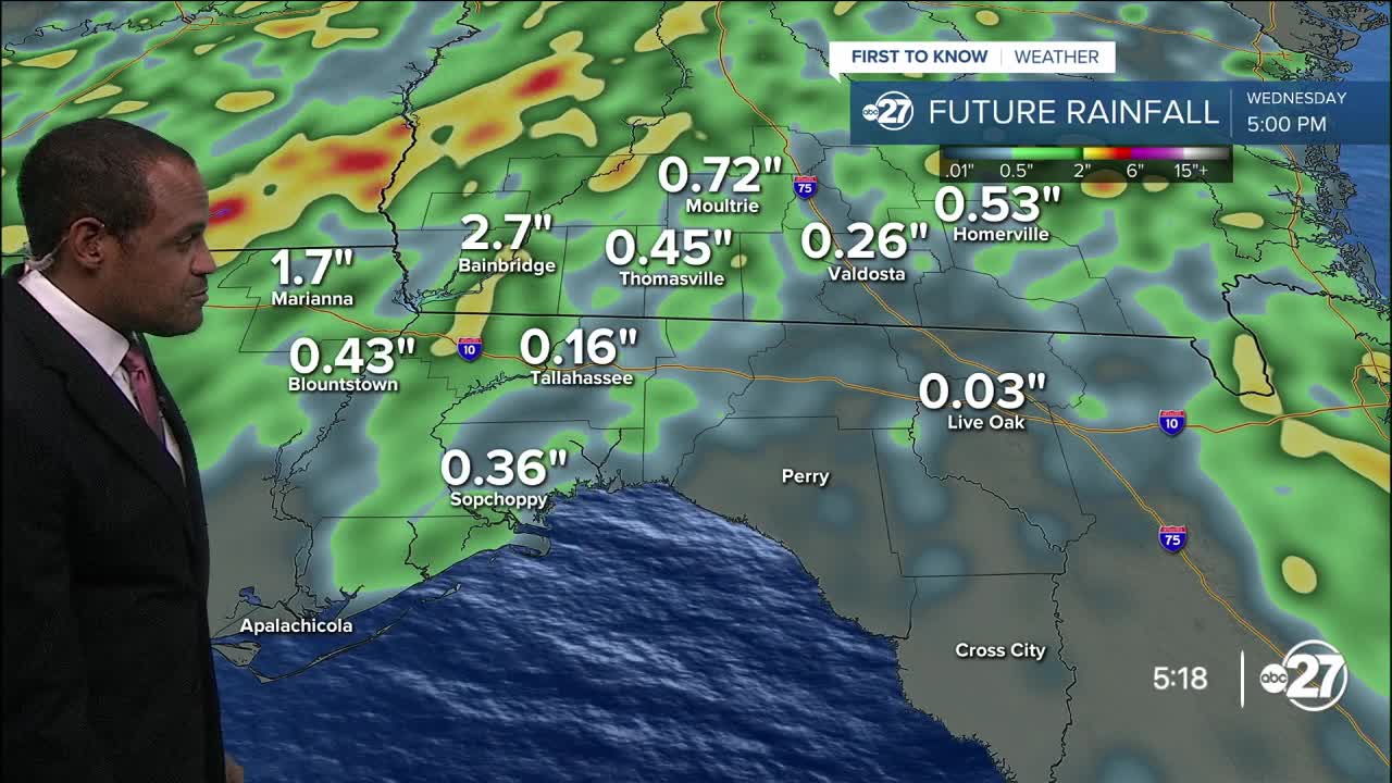
The cloudier pattern will yield slowly to more breaks of sun by midweek and beyond, but we'll have daily rain and thunderstorm activity that will cause locally soaked conditions. Organized severe weather is not likely to occur, but saturated areas that get more downpours can encounter temporary flooding issues.
A flood watch remains in effect for most local counties until early Tuesday evening.
—Casanova Nurse, Chief Meteorologist
Want to see more local news? Visit the WTXL ABC 27 Website.
Stay in touch with us anywhere, anytime.
